


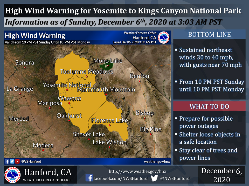
December 6, 2020 - The National Weather Service Hanford Office reports the High Wind Watch has been upgraded to a High Wind Warning for Yosemite to Kings Canyon National Park from 10:00 P.M. tonight until 10:00 P.M. Monday night.
A High Wind Warning means a hazardous, high wind event is imminent or is occurring.
Damaging wind gusts could blow down trees and power lines. Widespread power outages are possible. Travel will be potentially hazardous, particularly for high profile vehicles.
High Wind Warning
URGENT - WEATHER MESSAGE
National Weather Service Hanford CA
213 AM PST Sun Dec 6 2020

Central Sierra-
Including the cities of Devils Postpile, Florence Lake,
Lake Thomas Edison, Tuolumne Meadows, Bass Lake, Fish Camp,
and Wawona
213 AM PST Sun Dec 6 2020

...HIGH WIND WARNING IN EFFECT FROM 10 PM THIS EVENING TO 10 PM
PST MONDAY...

* WHAT...Northeast winds 25 to 35 mph with canyon wind gusts up to
  60 mph. Wind gusts up to 70 mph possible along the Sierra
  Nevada crest.

* WHERE...Central Sierra Nevada from Yosemite to Kings Canyon
  National Park.

* WHEN...From 10 PM this evening to 10 PM PST Monday.

* IMPACTS...Damaging winds will blow down trees and power lines.
  Widespread power outages are possible. Travel will be
  difficult, especially for high profile vehicles.

* ADDITIONAL DETAILS...Areas of high tree mortality may see
  widespread tree damage in strong wind gusts.

PRECAUTIONARY/PREPAREDNESS ACTIONS...

People should avoid being outside in forested areas and around
trees and branches. If possible, remain in the lower levels of
your home during the windstorm, and avoid windows. Use caution if
you must drive.
Source: NWS

