


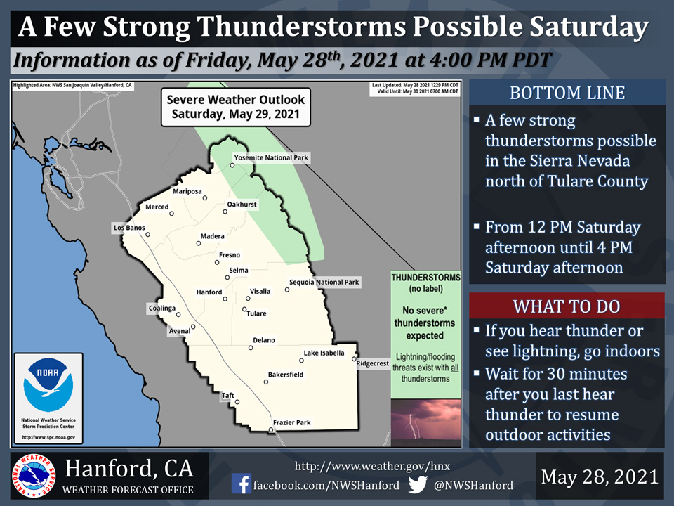
Includes Eastern Mariposa and Madera Counties and Yosemite National Park
May 29, 2021 - The National Weather Service reports isolated thunderstorms are possible this afternoon and early evening for the higher elevations of the Sierra Nevada, primarily from Fresno county north into the Yosemite area.
Small hail, heavy downpours, and dangerous lightning will be the primary hazards with these storms.
  Area Forecast Discussion
  National Weather Service Hanford CA
  456 AM PDT Sat May 29 2021


  .SYNOPSIS...High temperatures today will remain slightly above
  average for this time of year. A few thunderstorms are possible in
  the Sierra this afternoon and Sunday afternoon. Conditions will
  trend much warmer Sunday and Monday with maximum temperatures
  forecast to be around 15 to 20 degrees above normal then little
  change through midweek.


  &&

  .DISCUSSION...A weak shortwave trough is currently pushing into
  central and southern California. This is providing an onshore flow
  across the region and has deepened the marine layer to over 2500
  feet. This is deep enough to allow some cooler marine air to
  trickle into the Valley. This will keep some locations around
  Merced County at or even a degree or so below high temperature
  readings from yesterday, but across most of our area the passing
  weak trough will just help keep high temperatures from climbing
  too much above yesterday`s readings. Expect highs mostly a few
  degrees warmer, topping out around 3-6 degrees above normal for
  the end of May. The trough can also trigger a few afternoon
  thunderstorms over the Sierra.

  As the trough drops toward northern Baja by Sunday there may be a
  few thunderstorms near the Sierra crest, and temperatures will
  start an upward journey, with afternoon highs a few degrees above
  Saturday`s highs.

  While a closed low is developing in the northern Baja area,
  Pacific high pressure will build along the west coast, and our
  temperatures will increase more significantly for Memorial Day
  and into midweek. This will be the hottest stretch of weather we
  have experienced since early September of last year and highs will
  be as much as 20 degrees above normal, with some records
  threatened. This will lead to a moderate to high level of heat
  risk across the San Joaquin valley, lower foothills and westside
  hills Monday and Tuesday. A developing northeast Pacific trough
  will begin to weaken and displace the ridge on Wednesday and
  highs will start to trend downward. After Wednesday, as the trough
  further flattens the ridge overhead, the latter half of the week
  will see more significant cooling, with highs lowering to around
  7-10 degrees above normal by the end of the week.

  With the anticipated heat impacts for at least Monday and Tuesday,
  we have issued an Excessive Heat Watch for these days. Wednesday
  may also require special attention to the heat, as it will see
  just the beginning of the downward temperature trend, and high
  temperatures will likely be down only a couple of degrees.
Source: NWS

