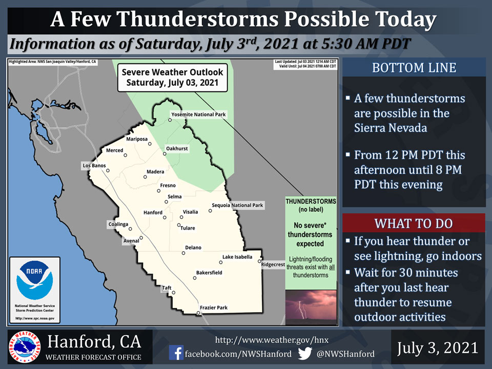
Includes Yosemite National Park and Oakhurst
July 3, 2021 - The National Weather Service Hanford Office reports a few thunderstorms are possible in the Sierra Nevada this afternoon into this evening.In addition to dangerous cloud to ground lightning strikes, any thunderstorm could produce small hail, gusty and erratic winds, and intense rainfall rates, leading to localized flooding.
  Area Forecast Discussion
  National Weather Service Hanford CA
  416 AM PDT Sat Jul 3 2021


  .SYNOPSIS...
  Isolated showers and thunderstorms will be possible over the
  Sierra Nevada each afternoon through Sunday. Otherwise dry and
  warm weather is expected, with temperatures running a few degrees
  above normal through the middle of next week. By late next week,
  temperatures will rise more sharply, increasing the risk of heat
  relate illnesses.

  &&

  .DISCUSSION...
  Southerly flow between a high pressure ridge over the southwest
  US and a low pressure center offshore is steering a slug of
  moisture and weak instability northward across southern and
  central California. Satellite and radar indicate associated
  clouds and mainly light/elevated precipitation pushing north over
  the Kern County desert. As the moisture continues moving north
  during the day today, expect additional precipitation development,
  with showers and a few thunderstorms possible over the Sierra
  zones. Temperatures meanwhile will top out around 5 degrees above
  climo this afternoon.

  The ridge is progged to expand westward and strengthen during the
  next few days. Additional afternoon thunderstorm activity can be
  expect over the Sierra Sunday as moisture lingers, while
  temperatures remain around 5 degrees above normal. As the ridge
  further builds westward, moisture will decrease and the
  thunderstorm threat over the Sierra will diminish for the
  remainder of next week. The gradually building ridge will maintain
  above normal temperatures across central California through the
  middle of next week.

  For the latter part of next week, the ridge is progged to
  continue strengthening, with 500 mb heights nearing 600 decameters
  by Saturday. This anomalously strong high pressure center would lead
  to a significant heat event for our region with afternoon highs
  reaching around 8-12 degrees above normal. These conditions will
  create increased risks for heat related illnesses in the San
  Joaquin Valley, lower foothills and desert areas by the end of
  next week.


  &&


  .AVIATION...
  MVFR/IFR conditions in and near showers and thunderstorms over the
  Sierra between 18z Sat and 02z Sun. VFR conditions will prevail
  elsewhere throughout Central California for the next 24 hours.

  &&

  .AIR QUALITY ISSUES...
  On Saturday July 3 2021... Unhealthy for sensitive groups in
  Tulare County and Sequoia National Park and Forest.
  Further information is available at Valleyair.org
Source: NWS


