


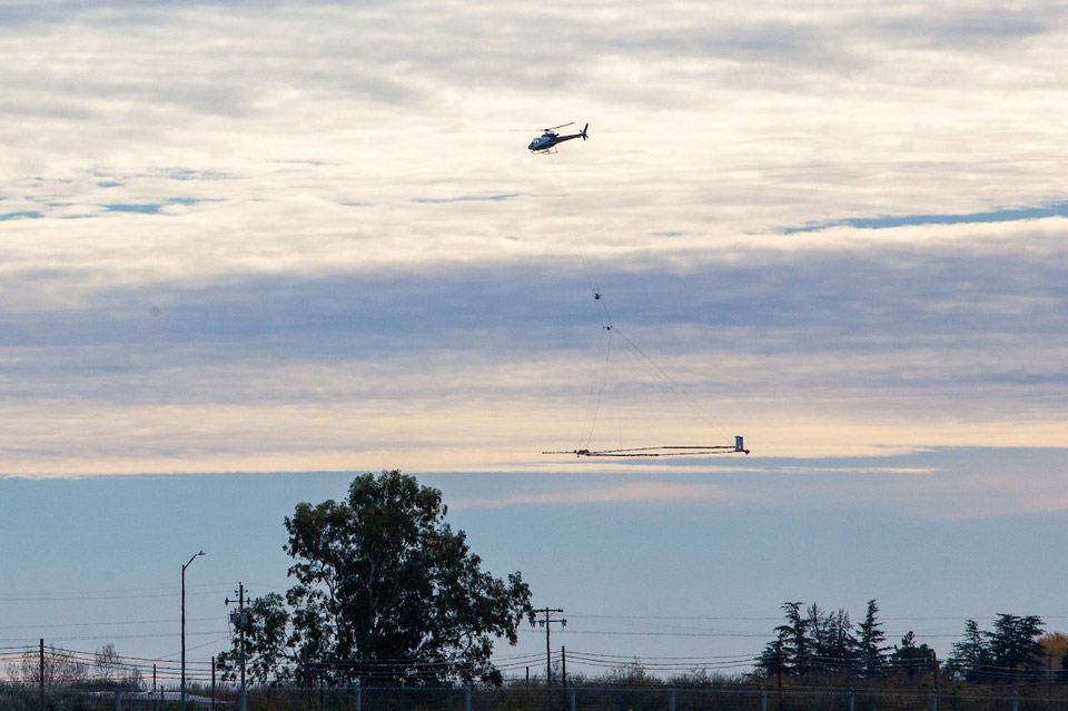
A helicopter takes off with airborne electromagnetic (AEM) equipment to survey a groundwater basin in California. Credit: DWR
July 15, 2021 - SACRAMENTO, Calif. – The California Department of Water Resources (DWR) is using an innovative, helicopter-based technology to gather information about the state’s groundwater aquifer structure to support drought response and the implementation of the Sustainable Groundwater Management Act (SGMA).
DWR’s use of airborne electromagnetic (AEM) surveys advances Governor Newsom’s Water Resilience Portfolio goal of using technology to support the State’s understanding of groundwater resources.
“The data collected during these surveys will provide a better understanding of California’s groundwater systems, and in turn support more informed and sustainable groundwater management and drought preparedness and response approaches,” said Steven Springhorn, DWR’s SGMA Technical Assistance Manager.
Beginning this month, DWR will conduct AEM surveys of groundwater basins in the Salinas Valley, Paso Robles and Cuyama Valley. During the surveys, a low-flying helicopter tows a large hoop with scientific equipment approximately 100 feet above the ground surface. The helicopter, flown by experienced and licensed pilots, will make several passes over the survey areas and may be visible to residents.
Surveys will be conducted over the next several years in high- and medium-priority groundwater basins around the state, where data collection is feasible.
Survey data creates an image of the subsurface down to a depth of about 1,000 feet below ground surface and provides information about large-scale aquifer structures and geology. This information supports the implementation of local groundwater sustainability plans (GSPs), which can help local agencies sustainably manage groundwater during drought. For more information, please watch DWR’s short 2-minute video on the introduction to the AEM method, provided in both English and Spanish.
For more information about the AEM surveys, visit DWR’s AEM project website. For questions, please email AEM@water.ca.gov.
Source: CA. DWR
