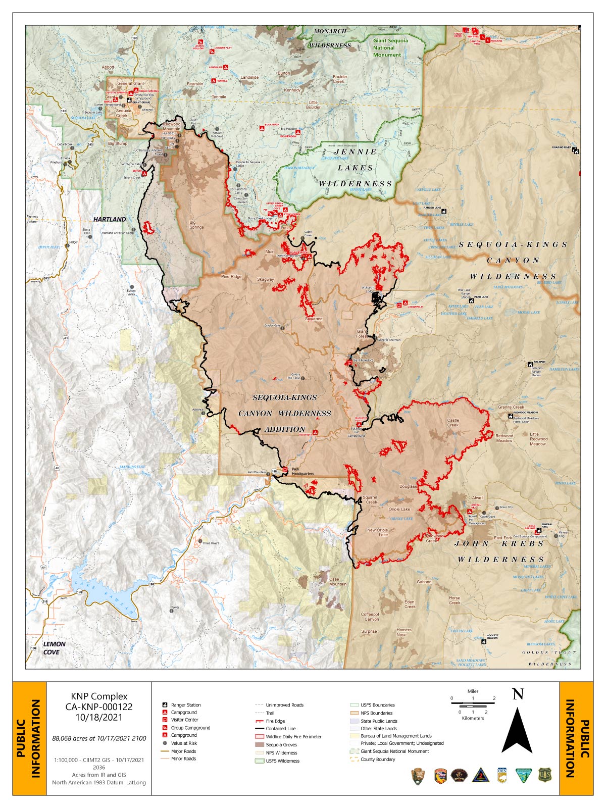
Monday's Infrared Map
Note: Map is 1,200 pixels wide.
October 18, 2021 - KNP Complex Fire in Sequoia National Park updates for Monday: 88,068 Acres with 55% Containment.
Overnight Infrared Flight Notes: Interpreted Size: 87,950 Interpreted Acres - Growth since last flight: About 124 Acres
-Clouds over entire target area. Judging isolated vs scattered heat more of a toss-up.
-Clouds were heavy over large areas which blocked all heat signatures in those areas. That is what is drawn on the map with the cloud tool.
-Large-ish finger moving north from East Fork Kaweah River towards Mineral King Road at Atwell Mill Ranger Station and Campground.
Click here for: KNP Complex Wildfires in Sequoia National Park Sunday, October 17, 2021 Updates
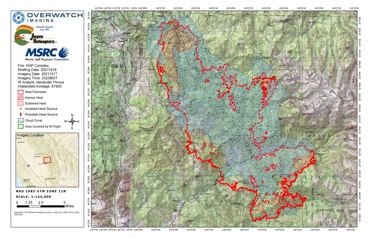
Monday's Public Information Map
Map Shows Uncontrolled Fire Edge.
Note: Map is 1,200 pixels wide.