


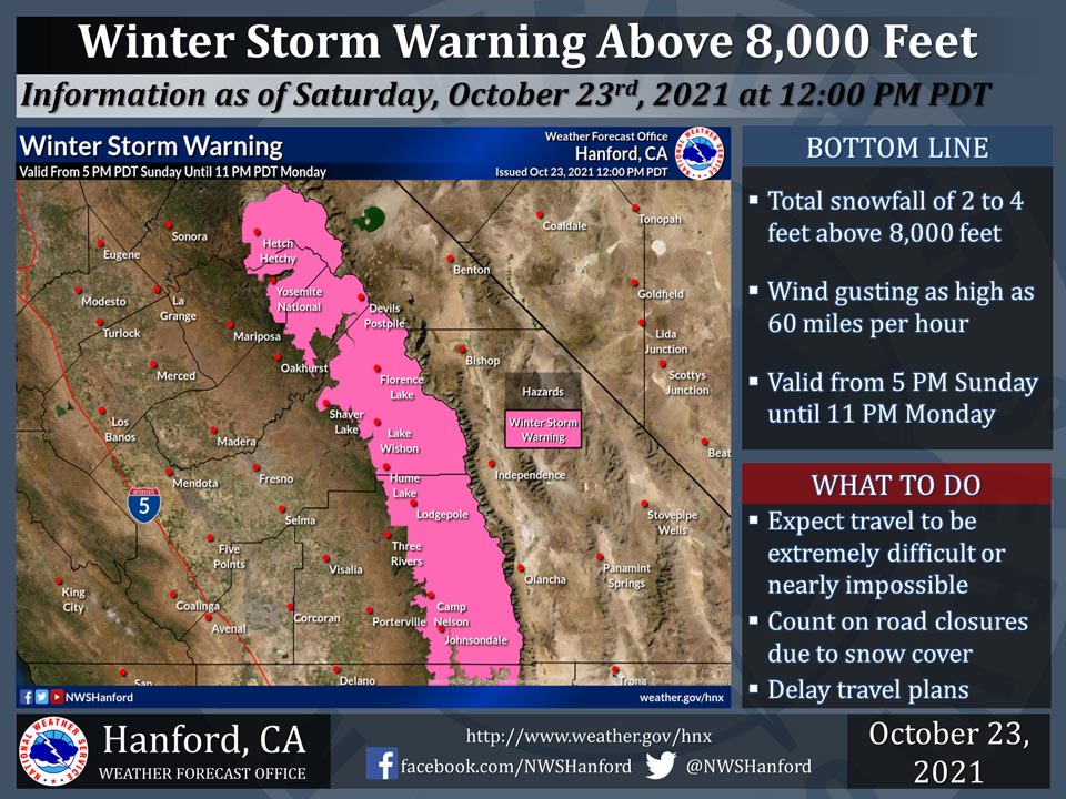
October 23, 2021 - The National Weather Service Hanford Office reports a Winter Storm Warning is in effect for the Sierra Nevada above 8,000 feet from 5:00 P.M. Sunday until 11:00 P.M. Monday.
The majority of this snow will fall late Sunday night and Monday morning.
Travel will be extremely difficult or impossible. If you plan to travel, consider alternate strategies.
For information on road conditions, including closures or delays, call Caltrans at 1-800-427-7623
Winter Storm Warning
URGENT - WINTER WEATHER MESSAGE
National Weather Service Hanford CA
1113 AM PDT Sat Oct 23 2021

Yosemite NP outside of the valley-Upper San Joaquin River-
Kaiser to Rodgers Ridge-Kings Canyon NP-Grant Grove Area-
Sequoia NP-South End of the Upper Sierra-
1113 AM PDT Sat Oct 23 2021

...WINTER STORM WARNING IN EFFECT FROM 5 PM SUNDAY TO 11 PM PDT
MONDAY ABOVE 8000 FEET...

* WHAT...Heavy snow expected above 8000 feet. Total snow
  accumulations of up to 48 inches. Winds gusting as high as 60
  mph.

* WHERE...Portions of central California.

* WHEN...From 5 PM Sunday to 11 PM PDT Monday.

* IMPACTS...Travel could be very difficult to impossible. The
  hazardous conditions could impact the morning or evening
  commute. Very strong winds could cause extensive tree damage.


PRECAUTIONARY/PREPAREDNESS ACTIONS...

If you must travel, keep an extra flashlight, food, and water in
your vehicle in case of an emergency.

The latest road conditions for the state you are calling from can
be obtained by calling 5 1 1.
Source: NWS
