


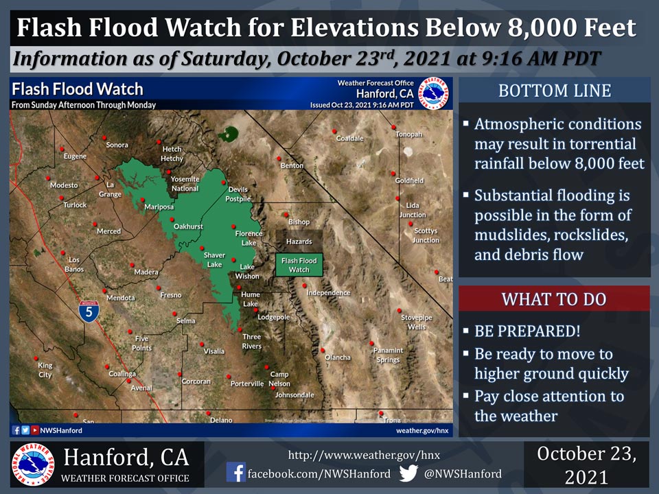
October 23, 2021 - The National Weather Service Hanford Office reports a Flash Flood Watch is in effect for the Sierra Nevada below 8,000 feet and adjacent foothills Sunday afternoon through Monday.
A Flash Flood Watch means that conditions may develop that lead to flash flooding.
Intense rainfall rates are possible in the Sierra Nevada and adjacent foothills below 8,000 feet, leading to the threat of mudslides, rockslides, and debris flow flooding, particularly in recently burned areas.
Some roads may become impassible or washed out, resulting in road closures.
The heaviest rain will fall late Sunday night and Monday morning.
Flash Flood Watch
Flood Watch
National Weather Service Hanford CA
855 AM PDT Sat Oct 23 2021

...FLASH FLOOD WATCH IN EFFECT FROM SUNDAY AFTERNOON THROUGH
MONDAY EVENING FOR THE CREEK FIRE, SQF COMPLEX, FRENCH FIRE, KNP
COMPLEX AND WINDY FIRE BURN SCARS...

.An intense band of precipitation will move through between Sunday
afternoon and Monday evening. Periods of moderate to heavy rain
are expected, especially Monday morning. These could bring
potential mud and debris flows over recent burn scar areas in
Madera, Fresno, Tulare and Kern Counties. Snow levels will be
high.

Mariposa-Madera Lower Sierra-Fresno-Tulare Lower Sierra-
San Joaquin River Canyon-Upper San Joaquin River-
Kaiser to Rodgers Ridge-
Including the cities of Bass Lake, Coarsegold, Fish Camp,
Oakhurst, North Fork, Auberry, Devils Postpile, Florence Lake,
Lake Thomas Edison, Lake Wishon, Huntington Lake, and Shaver Lake
855 AM PDT Sat Oct 23 2021

...FLASH FLOOD WATCH NOW IN EFFECT FROM SUNDAY AFTERNOON THROUGH
MONDAY EVENING...

The Flash Flood Watch is now in effect for

* A portion of central California, including the following
  areas, Fresno-Tulare Lower Sierra, Kaiser to Rodgers Ridge,
  Mariposa-Madera Lower Sierra, San Joaquin River Canyon, and
  Upper San Joaquin River.

* From Sunday afternoon through Monday evening

* Flash flooding is possible over and near recently burned areas
  including the Creek Fire burn area.

* Mudslides and debris flows are also possible over and near
  recently burned areas.

PRECAUTIONARY/PREPAREDNESS ACTIONS...

A Flash Flood Watch means that conditions may develop that lead
to flash flooding. Flash flooding is a VERY DANGEROUS SITUATION.

You should monitor later forecasts and be prepared to take action
should Flash Flood Warnings be issued.
Source: NWS
