


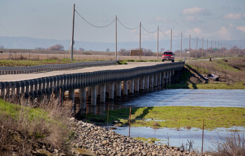
View of the West Washington Road Bridge in the Eastside Bypass in Merced County
DWR photo taken January 25, 2017.
The San Joaquin Valley has sunk 33 feet in less than 100 years causing major reginal infrastructure challenges; first of its kind map will reduce up to $30 billion in future hazard costs
February 20, 2022 - WASHINGTON – Last Friday, Rep. Josh Harder sent a bipartisan letter to House and Senate leaders urging them to invest in 21st century satellite technology to measure land subsidence nationwide. In the last 100 years the San Joaquin Valley has sunk, or subsided, by at least 33 feet, causing significant regional infrastructure challenges. See below and online here for a photo of the impact.
“Our state is sinking and that puts everything from our roads and bridges to our farms and jobs at risk,” said Rep. Harder. “That’s why today I’m pushing for a bipartisan investment in the 21st century satellite technology that will tell us exactly what we need to know about our lands. If we make this investment now, we’ll save up to $30 billion nationwide and stimulate our local economies at the same time. We know what to do, we know how to do it, so let’s get to work.”
Rep. Harder’s letter, also signed by Republican Rep. Maria Salazar, urges congressional leadership to fund the United States Geological Survey (USGS) National Land Level Change (NLLC) Mapping Program which will utilize the latest in satellite imagery to create a first-of-its-kind map measuring land subsidence across the United States. Funding this program now will reduce the up to the $30 billion that land-subsidence hazards cost the United States and stimulate economic markets in coastal resilience, transportation, and power generation.
Read the letter below and online here.
Dear Speaker Pelosi, Minority Leader McCarthy, Majority Leader Schumer, and Minority Leader McConnell:
As the House and Senate continue deliberations on the final Fiscal Year (FY) 2022
appropriations bill, we write to you in support of report language and funding for the United States Geological Survey (USGS) National Land Level Change (NLLC) Mapping Program. This mapping program will utilize the latest in satellite imagery to create a first-of-its-kind map measuring land subsidence across the United States. For many of our nation’s inland and coastal communities, including our own congressional districts, this will provide essential information to inform the construction of resilient infrastructure and save money in the long-term.
The few regions that have been measured for land subsidence demonstrate the dire need for this mapping program. In less than 100 years, California’s San Joaquin Valley has sunk 33 feet and Louisiana’s coastline has continued to sink at a rate of one third of an inch per year. As long as we lack a comprehensive land subsidence map, inland and coastal communities at-risk of subsidence-related hazards won’t have the tools to address them.
In 2021, the passing of the National Landslide Preparedness Act authorized the Secretary of the Interior to subject USGS programs for land subsidence research and mapping. The land subsidence provision in this law must be paired with appropriations in FY 2022 to ensure that state-of-the-art satellites are used to develop a comprehensive land-level change map. Funding this program now will reduce the $20 to $30 billion that land-subsidence hazards cost the United States and stimulate economic markets in coastal resilience, transportation, and power generation.
Throughout the House Appropriations process, there was strong support for funding the NLLC Mapping Program. As the House adopted bipartisan amendment #176 to the FY 2022 bill which is an increase decrease amendment for the USGS NLLC Mapping Program. In addition to the bipartisan amendment, the House FY 2022 Interior and Environment report included language supporting USGS’s academic partnerships that map elevation changes in coastal regions. We strongly support and encourage these efforts.
We also request that the following report language from the Senate FY 2022 Interior and Environment report be included in the final FY 2022 appropriations bill: “The Committee recognizes efforts to utilize technology and models to assess and make public information on land level change, particularly in areas facing major coastal land loss challenges like the North-Central Gulf of Mexico and Central Atlantic Coastal Plain. The Committee encourages the Survey to evaluate and develop funding estimates for such a program and directs the Survey to brief the Committee on findings within 180 days of the enactment of this act.”
However, we specifically ask that the Senate add the following language, “and any other areas in the United States that are facing land loss changes” after “Central Atlantic Coastal Plain.”
This change ensures that the NLLC Mapping Program is a nationwide subsidence mapping program and not limited to specific regions of the U.S. With this amended language and funding for the NLLC Mapping Program in the final FY 2022 appropriations bill and report, we believe that inland and coastal communities will be able to effectively mitigate land subsidence hazards.
Thank you for your consideration of our request and we look forward to working with you to develop a stronger and more resilient nationwide land subsidence map.
Source: Congressman Josh Harder
Related: DWR Reports New Data Shows Subsidence Continued in Water Year 2021, But Pace Slower than Seen in Previous Droughts - Includes Assessments for Many of the Groundwater Basins in Merced, Madera, Fresno, Kings, Tulare, and Kern Counties
