


U.S. Geological Survey and Department of Energy Los Alamos National Laboratory partner to advance fire research capabilities supporting the work of fire-, land- and emergency managers
April 21, 2022 - RESTON, Va. – This month, the U.S. Geological Survey (USGS) and the Department of Energy Los Alamos National
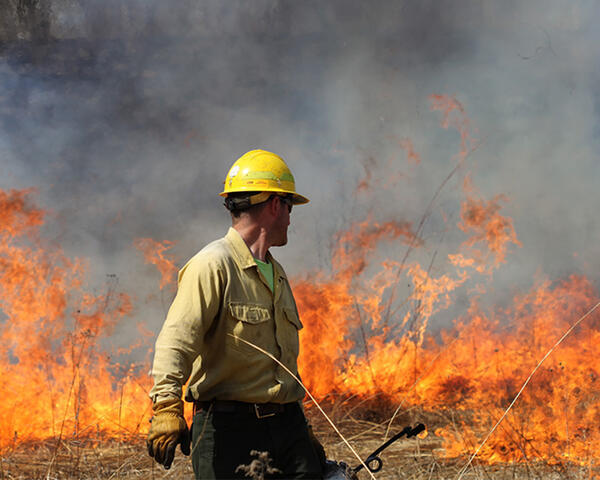
A firefighter wearing safety gear and holding a drip torch walks away from a line of burning vegetation.
Sources/Usage: Public Domain.
Laboratory entered into a partnership to produce advanced computer models used to predict how wildfires will behave in different situations. These wildfire modeling tools will help fire-, land- and emergency managers plan for, respond to and study the effects of fire on natural landscapes and in the wildland-urban interface.
The partnership, which was formalized on April 15 with the signing of a Memorandum of Understanding, combines the long-term fire- and land management science and vegetation mapping expertise of the USGS with the advanced modeling capabilities of the Los Alamos National Lab.
“The partnership between these two agencies creates an unparalleled opportunity to meet fire managers’ needs at local- to continental scales in the priority areas of climate-fire impacts, natural hazards and risk reduction, and ecosystem response to fire”, said U.S. Geological Survey Associate Director of Natural Hazards Exercising the Delegated Authority of the Director Dave Applegate.
Fire models help managers plan prescribed fires, including where and when these should be implemented. They also can help managers understand and forecast where a wildfire will move and its intensity, saving lives and resources. But current fire models have limitations that reduce their usefulness and accuracy.
Over the last 20 years, the Los Alamos National Laboratory has developed advanced fire-modeling tools, called coupled fire-atmospheric feedback models, which overcome the limitations of existing fire models. The Los Alamos National Laboratory’s fire models can integrate fire behavior with ecological variation, such as subtle changes in vegetation, before, during and after fires. However, the models need up-to-date, high-resolution data, such as weather conditions and available burnable material, to produce high-quality results on fire behavior.
For decades, the USGS has produced fire-related science, national datasets and tools to support Department of the Interior land-management agencies. More recently, the USGS has collected high-resolution remote sensing data that can be used to classify vegetation and other fuels on the landscape. USGS lidar data will increase the accuracy of the Los Alamos National Laboratory’s models.
“This partnership leverages USGS expertise in 3D mapping of terrain and vegetation to support the application of the Los Alamos National Laboratory suite of advanced fire-modeling tools and will provide science support to both research communities and fire managers, who will increasingly rely on more sophisticated understanding of fire behavior to confront novel fire behavior under a changing climate,” said U.S. Geological Survey Associate Director for Ecosystems Anne Kinsinger.
Beyond advancing fire-behavior models, this partnership will also formalize work already being undertaken between the two agencies to test modeling results on federal lands. It will also allow for the creation of a virtual interagency fire-climate-ecosystem modeling center to sustain and apply emerging modeling technology to real-world fire challenges faced by federal, Tribal, state and local land managers.
“We are aiming to create a whole that is greater than the sum of the independent parts,” said Wildfire-modeling Team Lead at Los Alamos Rod Linn. “Increasingly available higher-fidelity data describing the fire environment, such as fuels, atmosphere and topography, enables modeling efforts to envision and realize a more comprehensive description of fire behavior and fire effects. Forward-thinking model development can inspire creative data collection and mapping directions.”

USGS scientists Jeff Cordova and Fletcher Brinkerhoff set up the LiDAR and GPS equipment to survey a burned watershed within the Yarnell Hill Fire.
Sources/Usage: Public Domain.
Source: USGS
