


June 3, 2022 - Ten large fires have burned 674,847 acres in four states. No new large fires were reported yesterday. More than 4,700 wildland firefighters and support personnel continue to work toward 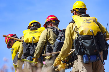 containment goals on incidents across the Southwest, Rocky Mountain, and California areas.
The fuels and fire danger outlook produced by Predictive Services at the National Interagency Coordination Center (NICC) indicates that the Southwest, southern Great Basin and western Colorado will continue to experience elevated fire danger until the arrival of the monsoons. Alaska will see hot and dry conditions next week that could increase wildfire potential. And critical conditions in central California continues to increase the potential for wildfires. Take a look a their fuels and fire danger briefing on the NICC website.
The Predictive Services staff also released the significant wildland fire potential outlook for June, July, August and September. The monthly seasonal outlook podcast is also available.
Isolated to scattered mixed wet and dry thunderstorms are likely again tomorrow along and east of the Divide in Colorado and New Mexico, with pyrocumulonimbus development possible if any large fire becomes very active. Some of these storms could produce severe outflow winds, large hail, and brief periods of heavy rain, especially along the eastern slopes of the Rockies in Colorado and New Mexico. West-southwest sustained winds of 12-20 mph gusting 20-35 mph and minimum RH of 5-20% are expected across the southern Great Basin, west of the Divide in the Southwest, and on the Western Slope. Some of these conditions are likely to spread east of the Divide late in the afternoon into the evening across portions of western and central New Mexico. Alaska will remain hot and dry, with isolated thunderstorms likely over south- central Alaska and the eastern Interior. Isolated to scattered showers and thunderstorms are expected across portions of the Inland Pacific Northwest, northern Great Basin, and northern Rockies. Some of the storms across the northern Great Basin are likely to be drier, but there is little to no risk of significant fires. Heavy rain is expected across South Florida associated with a tropical disturbance, which could also bring tropical storm force winds to South Florida by tonight.
| Number of new large fires or emergency response * New fires are identified with an asterisk |
0 | States currently reporting large fires: |
| Number of active large fires Total does not include individual fires within complexes. |
10 | |
| Acres from active fires | 674,847 | |
| Fires contained | 1 |
Year-to-date statistics
| 2022 (1/1/22-6/03/22) | Fires: 28,123 | Acres: 1,920,689 |
| 2021 (1/1/21-6/03/21) | Fires: 25,900 | Acres: 712,665 |
| 2020 (1/1/20-6/03/20) | Fires: 19,344 | Acres: 467,773 |
| 2019 (1/1/19-6/03/19) | Fires: 15,148 | Acres: 280,661 |
| 2018 (1/1/18-6/03/18) | Fires: 24,353 | Acres: 1,725,561 |
| 2017 (1/1/17-6/03/17) | Fires: 25,087 | Acres: 2,221,336 |
| 2016 (1/1/16-6/03/16) | Fires: 20,838 | Acres: 1,661,572 |
| 2015 (1/1/15-6/03/15) | Fires: 22,422 | Acres: 427,390 |
| 2014 (1/1/14-6/03/14) | Fires: 22,089 | Acres: 739,875 |
| 2013 (1/1/13-6/03/13) | Fires: 18,207 | Acres: 307,321 |
| 2012 (1/1/12-6/03/12) | Fires: 22,511 | Acres: 803,275 |
10-year average Year-to-Date
| 2012-2021 | Fires: 21,502 | Acres: 915,483 |
Source: NIFC Photo credit: NIFC
