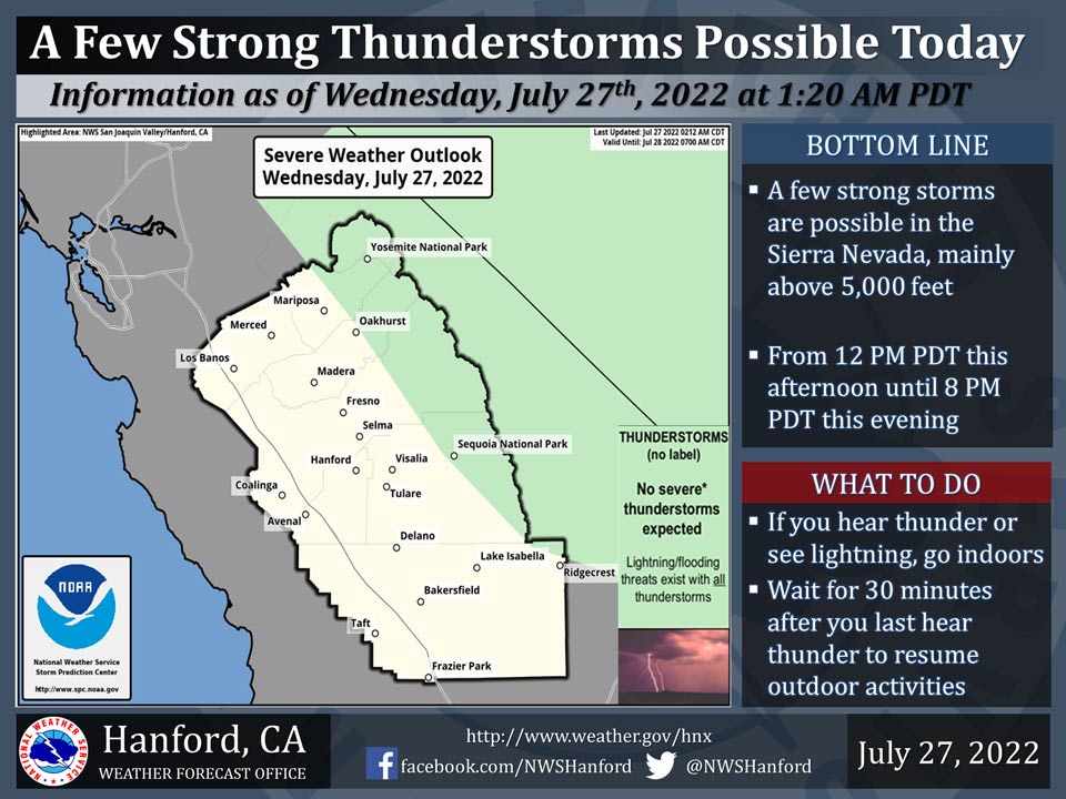
Includes Eastern Madera and Mariposa Counties and Yosemite National Park
July 27, 2022 - The National Weather Service Hanford Office reports a few strong thunderstorms are possible in the Sierra Nevada, mainly above 5,000 feet, from 12:00 P.M. this afternoon until 8:00 P.M. this evening.
Dangerous cloud to ground lightning strikes, wind gusts near 45 mph, and small hail are hazards associated with strong thunderstorms.
Area Forecast Discussion
National Weather Service Hanford CA
251 AM PDT Wed Jul 27 2022
.SYNOPSIS...
Smoke from the Oak Fire will become the primary focus for the
next few days with the triple digits and afternoon thunderstorms
over the Sierra being the secondary stories.
&&
.DISCUSSION...
An upper level ridge will start to build this afternoon and will
continue through Friday and is being centered around the Sierra
Nevadas to the Great Basin in Nevada. The building ridge will
shift the wind directions to be more northeasterly which will push
the smoke towards Fresno, Tulare, and the eastern portion of
Kings County.
Temperatures this afternoon will generally be in the upper 90s
with some spots including Hanford getting as high as 101 which is
cooler than it has been lately. The shift in the smoke direction
plays a factor into the decrease as the smoke will reduce some of
the solar radiation from hitting the ground.
The afternoon thunderstorms over the Sierra Nevada crest will
continue to persist until next week. The thunderstorms are favored
due to more moisture in the mountains as well as up to 200-300 J/kg
of CAPE.
&&
.AVIATION...
Periods of MVFR or lower visibility are likely due to the smoke
from the Oak Fire being trapped in the Boundary Layer.
Thunderstorms are expected to fire off in the Sierra Nevada
between 18Z Wednesday and 03Z Thursday.
&&
.AIR QUALITY ISSUES...
On Wednesday July 27 2022... Unhealthy for Sensitive Groups in
Fresno... Kern... Madera and Tulare Counties... and Sequoia
National Park and Forest.
Source: NWS


