


Click Here for California Fires
Siskiyou County McKinney Fire Updates for Wednesday, August 3, 2022
August 3, 2022 - Currently, 62 large fires and complexes have burned 1,626,413 acres in 15 states. Three new large fires were reported, one each in Arkansas, California and Texas. Nearly 10,000 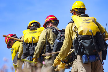 wildland firefighters and support personnel are assigned to incidents across the country. Four Type 1 incident management teams (IMTs), six Type 2 IMTs, and two Complex IMTs are assigned to incidents. Complex IMTs are configured to respond to large, complex fires and can expand and reduce staffing in all functional areas as necessary to meet the needs of the incident.
The national preparedness level (PL) is currently at level 3 (on a scale of 1 to 5). The National Multi-Agency Coordination Group, or NMAC, establishes a PL to help assure wildland firefighting resources are ready to respond to new incidents across the country. NMAC considers fuel and weather conditions, fire activity and resource availability in the Geographic Areas when setting the preparedness levels. A similar group establishes PLs at each geographic area. Right now, Northern California, Great Basin and Northern Rockies are also at PL 3.
The Predictive Services staff at the National Interagency Coordination Center released the significant wildland fire potential outlook for August, September, October and November. For additional information, visit the Predictive Services fuels and fire danger summary, fire weather and potential briefing, and the seven-day significant fire potential outlook.
Elevated to critical conditions will develop along and east of the Divide in Montana with elevated conditions likely into northeast Wyoming and western South Dakota as westerly winds of 15-25 mph continue amid RH of 15-25%. Elevated conditions will develop in the Columbia Basin and Cascade Gaps as well. Isolated to scattered mixed wet and dry thunderstorms will develop in far northeast California into much of central and eastern Oregon this afternoon with isolated thunderstorms possibly continuing overnight into central Idaho. Meanwhile scattered wet thunderstorms will continue over the southern Great Basin, Southwest, and central Rockies. Hot, dry, unstable, and breezy conditions are likely across the southern Plains, with elevated conditions most likely across portions of central Texas into southwest Oklahoma. Scattered wet thunderstorms are expected to develop from the Texas and Oklahoma Panhandles extending northeast through southern and eastern Kansas to the Great Lakes ahead of a cold front. Additionally, thunderstorms are likely in the Southeast, especially on the central Gulf Coast.
| Number of new large fires or emergency response * New fires are identified with an asterisk |
3 | States currently reporting large fires: |
| Number of active large fires Total does not include individual fires within complexes. |
62 | |
| Acres from active fires | 1,626,413 | |
| Fires contained | 1 |
Year-to-date statistics
| 2022 (1/1/22-8/03/22) | Fires: 39,767 | Acres: 5,795,506 |
| 2021 (1/1/21-8/03/21) | Fires: 38,207 | Acres: 3,259,913 |
| 2020 (1/1/20-8/03/20) | Fires: 32,563 | Acres: 2,190,681 |
| 2019 (1/1/19-8/03/19) | Fires: 27,061 | Acres: 3,360,943 |
| 2018 (1/1/18-8/03/18) | Fires: 38,535 | Acres: 4,981,070 |
| 2017 (1/1/17-8/03/17) | Fires: 39,635 | Acres: 5,730,848 |
| 2016 (1/1/16-8/03/16) | Fires: 34,898 | Acres: 3,600,570 |
| 2015 (1/1/15-8/03/15) | Fires: 36,754 | Acres: 5,929,374 |
| 2014 (1/1/14-8/03/14) | Fires: 34,151 | Acres: 1,702,600 |
| 2013 (1/1/13-8/03/13) | Fires: 28,398 | Acres: 2,417,275 |
| 2012 (1/1/12-8/03/12) | Fires: 38,255 | Acres: 4,346,788 |
10-year average Year-to-Date
| 2012-2021 | Fires: 34,613 | Acres: 3,665,550 |
Source: NIFC
