


California and National Drought Summary for August 18, 2015
Summary
This week a southwesterly flow returned to the Southeast, ushering in a tropical like air mass that produced widespread precipitation across the region. Meanwhile, a strong upper level low developed in the Midwest, producing heavy rains, which prompted flash flood watches. Warm, dry air continued to dominate the West.Hawaii, Alaska and Puerto Rico
No changes to the drought conditions were made this week.Northeast
While on the dry side this week, some rain did fall, albeit in spotty, summertime convective storms. After some D0 expansion last week, most of the Northeast is holding steady this week. The lone exception is in western Pennsylvania where D0 conditions were introduced due to the short term indicators. Up to two inches of rain fell in parts of the Northeast, while temperatures were as much as 4 degrees above normal.Northern Rockies / Plains and Northwest
Above-normal precipitation effected western South Dakota, southeast Montana and northeast Wyoming during the period. Temperatures in those areas were running as much as 6 degrees above normal. As a result of the recent rains, the remaining D0 was removed in Nebraska and South Dakota. Warmer-than-normal temperatures and large precipitation deficits continued to hold their grip on Washington and Oregon this week. D3 conditions were expanded in Washington where hay growers are suffering from millions of dollars in losses due to the ongoing warm, dry conditions. It was also reported that pear and apple trees are stressed along with hops.South
Short term dryness has caused expansion of drought across much of Texas and eastern Oklahoma. Warmer-than-normal temperatures have exasperated the situation. In Oklahoma, it was reported that soil moisture levels were approaching lows that we had not seen since August 2012. Drought was expanded in the southeast corner of Oklahoma and introduced in the northern part. Elsewhere, temperatures were 2-4 degrees above normal this past week in much of Texas. Drought conditions were expanded in much of east central Texas while a portion of southern Texas continued its drought free status.Southeast
After a hot and dry summer, moist southwest flow dominated much of the region during the week. Widespread precipitation occurred ahead of a weak cool front. Unfortunately, the bulk of the precipitation missed the drought stricken areas that needed it the most. The increase in cloud cover suppressed daytime temperatures. This was most evident in Tennessee where the average temperature departure was 4 degrees below normal. Drought improvement occurred in northern Georgia and northern Alabama, while degradation occurred in southeast Georgia and western South Carolina. Soil moisture conditions continue to deteriorate across central North Carolina, resulting in an introduction of D1 conditions. In Florida, a slight shift in the D3 designation towards the Everglades was made where water levels are nearly 2 feet below normal for this time of year. Recent rainfall along the coastal southeast Florida has eased conditions there, thus improving the metro areas of Broward and Miami-Dade counties by one category.Southwest
The monsoon season brought some good rains into Arizona prompting drought improvements in southeast Arizona. Cooler-than-average temperatures were seen in portions of Colorado and Utah. It was reported that eastern Colorado had started to dry out, but thanks to the spring moisture and cooler than normal temperatures for much of the summer, evaporative demand has been lower than average. Consequently, the soils have been able to retain the moisture and prevent drought degradation. Temperatures for the period were generally warmer than average across the region. Drought was contracted in southeast Arizona and southwest New Mexico.Upper Midwest
A large complex storm system brought heavy rains and thunderstorms to Iowa, South Dakota, Minnesota and Wisconsin during the latter part of the period. Upwards of 5 inches of precipitation fell in northwest Iowa resulting in flooding concerns. Elsewhere across the region, 1-2 inches were common. Temperatures were near normal in the southern part of the region but increased to 5 degrees above what is typically expected this time of year. Drought degradation occurred along the Lake Superior coastline due to the 30-90 day precipitation deficits.West
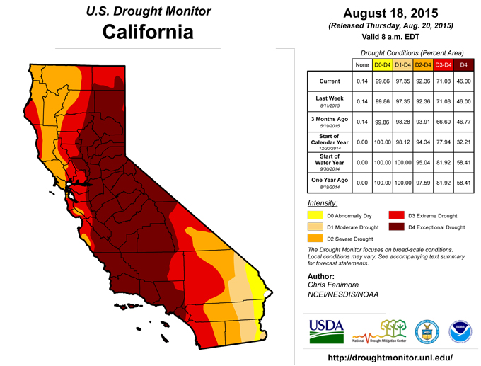
California continues to deal with its ongoing drought. Water managers and farmers are adapting their practices to help conserve water and reduce economic loss in the state. Temperatures in California were warmer than average in the south, gradually transitioning to cooler than average northwards. The only precipitation that fell during the period was in south and east Nevada.Looking Ahead
During the next 6-10 days, the probability of cooler than normal temperatures are high in the Ohio and Tennessee River Valley’s extending into the Great Lakes and Midwest. Chances are likely that the rest of the country will experience warmer than normal temperatures, especially in the Northeast, Southeast, and Southwest.Over the same period, precipitation associated with the large system centered over Wisconsin will move through the Great Lakes area. Further south, the precipitation will slowly move eastward and dissipate as the low pressure moves into Canada. Another, less powerful and dryer system will follow producing the heaviest precipitation in the Midwest. Ridging continues to hold its grip in the West while monsoonal precipitation may bring light drought relief in the Southwest
Author(s):
Chris Finimore, NOAA/NESDIS/NCEI
Dryness Categories
D0 ... Abnormally Dry ... used for areas showing dryness but not yet in drought, or for areas recovering from drought.Drought Intensity Categories
D1 ... Moderate DroughtD2 ... Severe Drought
D3 ... Extreme Drought
D4 ... Exceptional Drought
Drought or Dryness Types
S ... Short-Term, typically <6 months (e.g. agricultural, grasslands)L ... Long-Term, typically >6 months (e.g. hydrology, ecology)
Source: The National Drought Mitigation Center
