


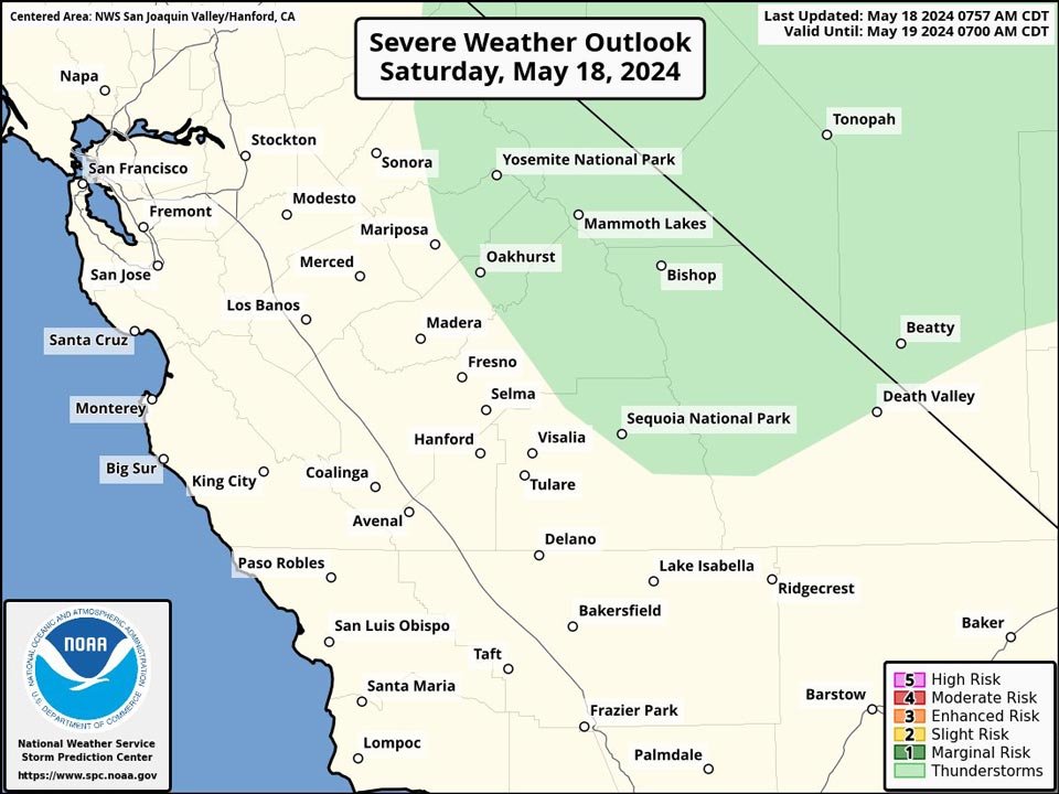
Possible Thunderstorms in the Sierra Nevada and foothills of Mariposa, Madera, Fresno and Tuolumne Counties including Yosemite National Park
May 18, 2024 - National Weather Service Hanford Office officials report strong thunderstorms are possible across the Sierra Nevada this afternoon and early evening.
The primary thunderstorm hazards will be dangerous cloud to ground lightning strikes, small hail, and wind gusts near 45 mph.
Area Forecast Discussion
National Weather Service Hanford CA
353 AM PDT Sat May 18 2024
.KEY MESSAGES...
1. Temperatures will remain a few degrees above normal through
the weekend.
2. There is a chance for strong thunderstorms across the Sierra
Nevada this afternoon and evening.
3. Gusty westerly winds will develop across the Kern County
mountains and desert each afternoon and evening with the strongest
gusts expected on Sunday and Monday.
4. Temperatures will lower to around normal next week.
&&
.DISCUSSION...
Maximum temperatures on Friday topped out around 3 to 7 degrees
above climatological normals for this time of the year. An upper
trough will gradually deepen over the west through the weekend
and into early next week. Temperatures will nudge down but a bit
this weekend but remain around 2 to 5 degrees above normal. Highs
are forecast to lower to around normal on Monday followed by a
slight uptick on Tuesday and Wednesday and then lowering back to
near normal for Thursday and Friday. Here are probabilities for
a high temperature of 88 degrees or higher for a few locations in
the San Joaquin Valley this afternoon.
Merced 46%Hanford 61%
Madera 46% Visalia 61%
Fresno 71% Porterville 51%
Reedley 26%Delano 51%
Lemoore 61%Bakersfield 61%
Moisture and instability are sufficient for a chance of showers
and thunderstorms across the Sierra Nevada this afternoon and
evening. Probabilities range from around 50 percent along the
Sierra crest down to around 20 percent for the upper foothills.
Dry conditions are forecast on Sunday then a 10 percent chance
for thunderstorms returns for Yosemite NP on Monday afternoon
and evening.
Westerly winds will increase across the Kern County mountains
and desert each afternoon and evening with the strongest gusts
expected on Sunday and Monday. A Wind Advisory may be needed
for a portion of this area.
&&
.AVIATION...
Areas of MVFR with local IFR in showers and thunderstorms over
the Sierra Nevada from 18Z Sat through 06Z Sun. Otherwise, VFR
conditions will prevail across the central CA interior for the
next 24 hours.
&&
.AIR QUALITY ISSUES...
None.
&&
.CERTAINTY...
The level of certainty for days 1 and 2 is high.
The level of certainty for days 3 through 7 is medium.
Certainty levels include low...medium...and high. Please visit
www.weather.gov/hnx/certainty.html for additional information
and/or to provide feedback.
&&
.HNX WATCHES/WARNINGS/ADVISORIES...
None.
Source: NWS

