ABC 30
Yosemite National Park Wildfire Prompts Evacuations
National Weather Service Meadow Incident Visible Satellite Imagery
Joe Coho "The smoke from the Meadow Incident in Yosemite National Park is visible in this loop of satellite images from the National Weather Service. The smoke is slightly above the center of the frame."
Click here or the image for the movie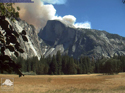
NPS Photo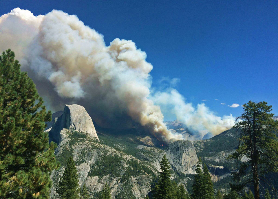
Yosemite National Park Official
The Meadow Fire is burning in the greater Little Yosemite Valley area and is at 400 acres.
All trails from the top of Nevada Fall to Merced Lake, including trails leading to that area, are closed. Additionally, the trail from Sunrise Lakes Trailhead to Sunrise Lakes and Sunrise Lakes High Sierra Camp, and the trails from the camp to the trail along the Merced River east of Little Yosemite Valley, are closed.
Currently, four type 1 helicopters, three type 3 helicopters, three air tankers, one air attack, six hotshot crews, and other resources are assigned to the fire.
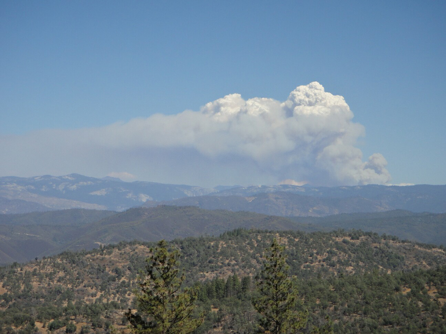
Meadow Fire at 5:15 P.M. from Streeter Mountain Road
Photo credit: Gary Hickman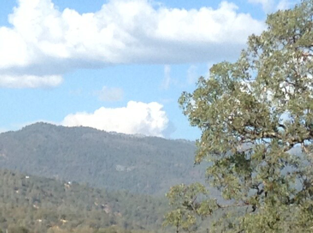
Meadow Incident MODIS Fire Detections 1700 MDT Sep 07 2014
Joe Coho "Meadow Incident MODIS Fire Detections 1700 MDT Sep 07 2014. The most recent detections were made by the Aqua Satellite at about 1357 PDT Sep 7 2014.
The detections are near the top of Nevada Fall in Little Yosemite Valley and toward Clouds Rest and Mount Starr King. This is confirmed by the Yosemite Conservancy webcam on Sentinel Dome."
Thanks to Joe Coho for the map.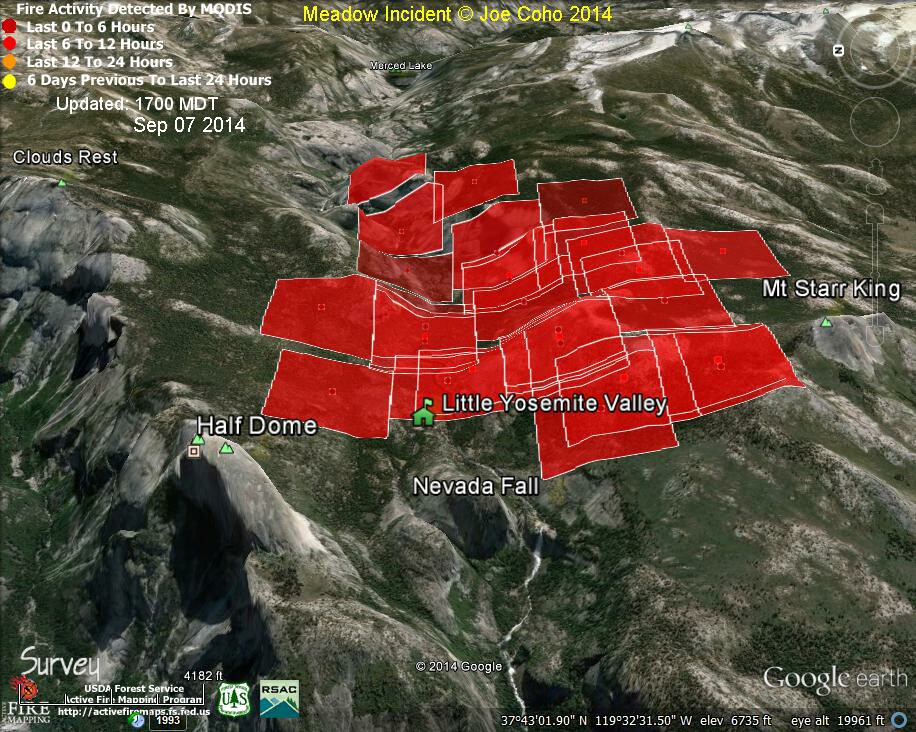
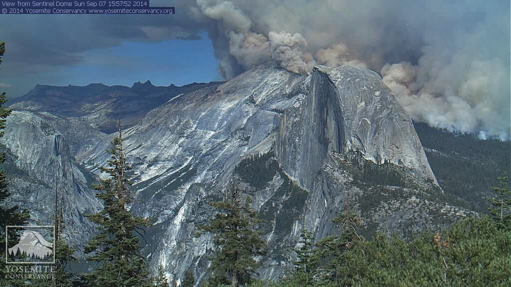
Photo Credit: Yosemite Conservancy
Meadow Incident MODIS Fire Detections 1545 MDT Sep 07 2014
Joe Coho "Meadow Incident MODIS Fire Detections 1545 MDT Sep 07 2014. The detections were made by the Terra Satellite at about 1220 PDT Sep 7 2014.
The detections are near the top of Nevada Fall in Little Yosemite Valley and toward Mount Starr King."
Thanks to Joe Coho for the Map.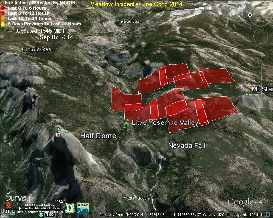
Meadow Incident Mini Movie by Joe Coho
Thanks Joe!
Photo Credit: Yosemite Conservancy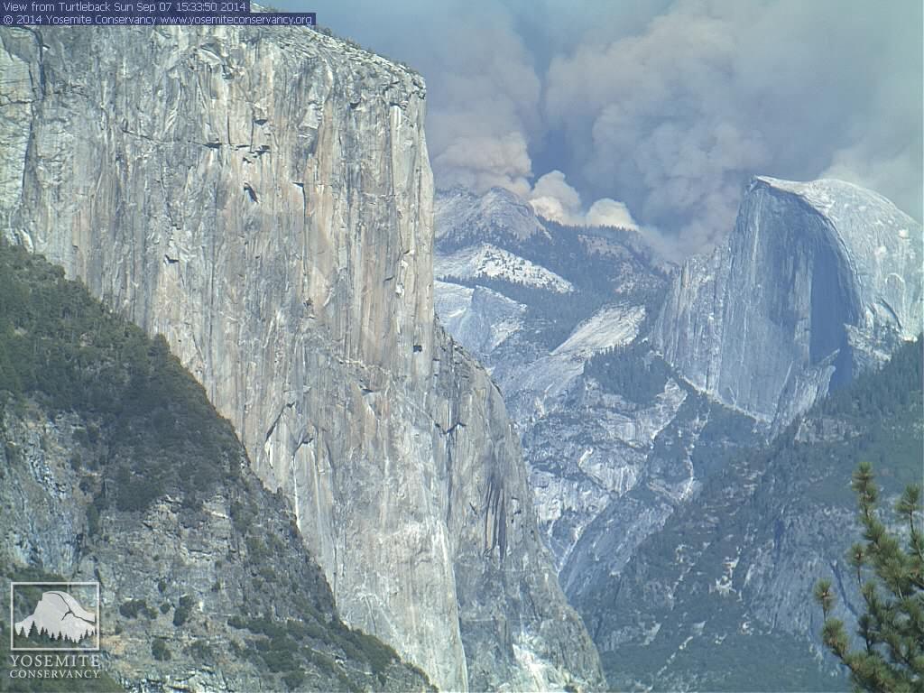
Meadow Incident General Location Map by Joe Coho
More accurate imagery to follow shortly.
This map is only showing the general location of the fire inferred by the web cams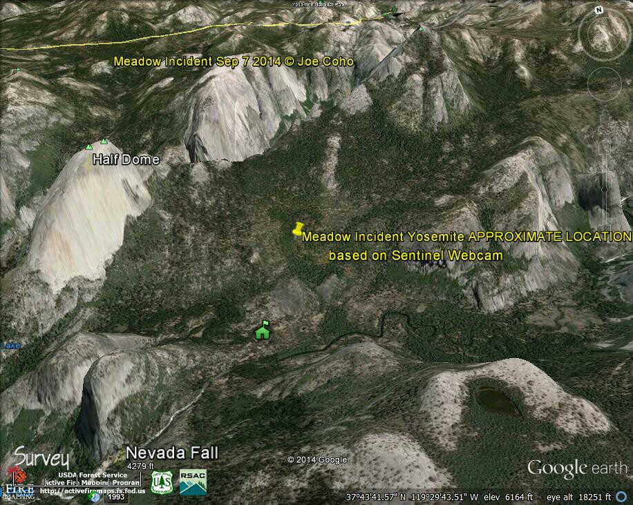
Meadow Incident
Photo Credit: Yosemite Conservancy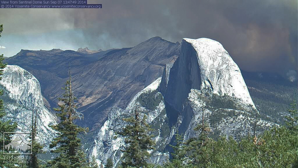
Photo Credit: Yosemite Conservancy 
Photo Credit Roger Biery