


California and National Drought Summary for June 24, 2025
Summary
June 26, 2025 - This week, widespread degradations occurred in the Northwest United States, where despite slightly cooler and wetter conditions this week, rapid drying continued to be a problem. In the central Great Plains and Midwest, scattered heavier rains led to improving drought or dryness conditions in some areas, especially in northern Missouri and Iowa, while some others who missed out on the heavier rains saw degrading conditions amid hotter-than-normal temperatures. In Florida, a mix of localized improvements and degradations occurred; scattered heavy rains improved the situation for some, while other areas that missed the heavy rain saw short- and long-term precipitation deficits grow amid worsening fire danger. After recent heavy rain, a small area west of Baltimore saw improvement to long-term moderate drought, while the most of the rest of the Northeast remained free of drought or abnormal dryness, with a small area of long-term moderate drought on Cape Cod continuing this week. A mix of improvements and degradations occurred in Texas following heavier rains last week in the south-central part of the state but drier weather in the Midland-Odessa area this week. Localized improvements occurred in areas of heavy rainfall on the eastern plains of New Mexico. Please note that any rain that fell from mid-Tuesday morning onward will be considered in next week’s map.
In Alaska, short-term abnormal dryness and moderate drought developed and expanded in parts of central Alaska, where short-term precipitation deficits built and fire danger increased.
In Hawaii, localized improvements and degradations occurred after an overall drier week with trade-wind showers on the windward sides of the islands.
In Puerto Rico, abnormal dryness developed along the northwest and south-central coasts where short-term precipitation deficits grew amid crop stress and decreasing groundwater levels.
Northeast
Warmer-than-normal temperatures occurred in the Northeast this week, with many areas reaching 2-8 degrees above normal for the week. Scattered rainfall amounts over 2 inches fell in parts of Maryland, western Pennsylvania, central New York and Maine, though most areas were already free of drought or abnormal dryness. Long-term moderate drought decreased slightly in coverage west of Baltimore after recent heavier rain amounts lessened long-term drought impacts there.
Southeast
Scattered heavier rains fell across the Florida Peninsula and in western Georgia and Alabama this week, otherwise the weather was mostly drier. Temperatures generally leaned a couple degrees above normal, except for Alabama (mostly near normal) and the Carolinas, which were mostly 2-6 degrees warmer than normal. Before this week, conditions had been wet across the region (outside of Florida) such that no drought or abnormal dryness developed despite the drier week. In the Florida Peninsula, scattered heavy rains (locally in excess of 5 inches) fell, leading to some improvements in ongoing drought. Some areas that missed out on the heavier rains, especially in the southeast coastal area of the Peninsula, saw conditions degrade as rainfall deficits and fire danger grew. Notably, a localized area of short- and long-term extreme drought developed near Palm Beach, indicative of localized high atmospheric thirst, fire danger, and very large long-term precipitation shortfalls.
South
Despite very hot weather this week in most of the region, widespread improvement occurred in northern Indiana, northern Illinois, southern Wisconsin, northern Missouri, Iowa and northeast Minnesota after heavy rains this week improved soil moisture conditions and tempered precipitation deficits. From northwest Missouri to southern Wisconsin, rainfall amounts were locally in excess of 5 inches. Further rains that fell after mid-Tuesday morning will be accounted for next week. In the Kansas City, Missouri and Urbana-Champaign, Illinois areas, abnormal dryness grew in coverage as soil moisture and streamflow dropped amid growing short-term precipitation deficits. Abnormal dryness also grew in coverage near Grand Rapids, Michigan, where short-term precipitation deficits and soil moisture deficits grew.
Midwest
Temperatures across the South region this week ranged from near-normal to 2-6 degrees warmer than normal in most of the region. Heavy rains fell in parts of central and northern Oklahoma, Tennessee, northeast Arkansas, Mississippi, and the western Texas and Oklahoma Panhandles. Most of central and south-central Texas had drier weather this week. Despite the dry weather there, some improvements to the Drought Monitor occurred in south-central Texas as the impact of recent heavy rains continued to be evaluated. A small increase in abnormal dryness and moderate drought occurred in the Midland-Odessa area due to growing short-term precipitation deficits and decreasing soil moisture and streamflow. Outside of Texas, the rest of the South remained free of drought or abnormal dryness.
High Plains
In Nebraska and Kansas, scattered heavy rains fell in parts of both states, especially in central and eastern areas, leading to localized improvements to ongoing drought and abnormal dryness. In some areas that missed heavier rains this week, temperatures ranging from 4-8 degrees hotter than normal led to degrading conditions, as streamflow and soil moisture levels dropped. Long-term drought over the last few years has continued to take a toll on trees in eastern Nebraska, as the bur oak, elm, hackberry, ash and red oak populations saw increased mortality or significant loss in canopy. Short- and long-term precipitation deficits continued to grow in parts of northern Colorado, which along with drops in soil moisture and streamflow led to localized worsening of drought or abnormal dryness. Meanwhile, heavier rains in the last couple of weeks in southeast Wyoming led to improving conditions there. The western half of Wyoming, in contrast, has continued to see rapid drying, leading to poor vegetation health and locally decreasing streamflow and soil moisture. Moderate and severe drought grew in coverage in parts of southwest Wyoming, while abnormal dryness grew in coverage northeast of Yellowstone National Park.
West
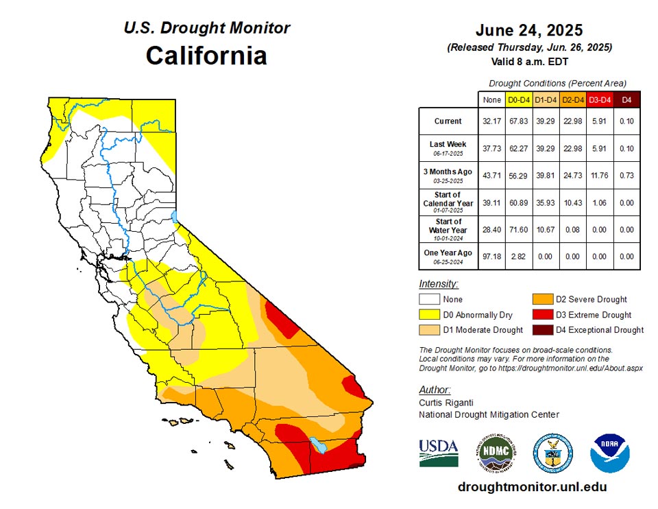
Predominantly cooler temperatures occurred in the West this week, with many areas west of Utah, Arizona and Wyoming seeing temperatures range from 2-8 degrees cooler than normal. Despite the cooler weather this week, the drying trend continued across much of the Northwest states, with abnormal dryness and moderate and severe drought significantly growing in coverage in northern portions of Utah and Nevada, northeast California, far western Montana, Idaho and southeast portions of Oregon and Washington. In these areas, short-term precipitation deficits are growing, streamflow is lower in spots, vegetation is struggling and soil moisture deficits are developing. Near the end of the week, scattered heavy rains fell in the eastern plains of New Mexico, leading to localized improvements in drought and abnormal dryness. The impact of these rains on the rest of the water cycle, as well as any further rain, will be further evaluated next week.
Caribbean
In Puerto Rico, abnormal dryness developed along the northwest and south-central coasts where short-term precipitation deficits grew amid crop stress and decreasing groundwater levels.
Across the U.S. Virgin Islands, mostly dry weather prevailed for the third consecutive week, following a wet May. During June, month-to-date rainfall at an assortment of official and volunteer (CoCoRaHS) observation sites has generally ranged from 0.50 to 2.00 inches. The 1-month Standardized Precipitation Index (SPI) indicates that abnormal dryness may be imminent, especially if drier-than-normal conditions persist. For now, some vegetation is just starting to exhibit mild stress, while groundwater levels remain mostly stable. On St. John, however, depth to water at the U.S. Geological Survey’s Susannaberg DPW 3 well increased to 10.8 feet by June 24, the greatest depth at any time in the last year.
Pacific
In Alaska, short-term abnormal dryness and moderate drought developed and expanded in parts of central Alaska, where short-term precipitation deficits built and fire danger increased.
Short- and long-term severe drought grew slightly in coverage on Molokai where vegetation impacts worsened amid growing precipitation deficits. Vegetation impacts improved in west-central portions of the Big Island coast, and in northwest portions of the island, leading to improvements there. Along the northeast coast, short- and long-term severe drought expanded slightly where vegetation conditions worsened.
In the U.S.-Affiliated Pacific Islands, most of the consequential drought remained focused across the Marianas and the Republic of the Marshall Islands (RMI). Drought-free conditions existed across American Samoa and the Republic of Palau, while drought in the Federated States of Micronesia (FSM) was limited to Pingelap. In fact, Pingelap, currently experiencing extreme drought (D3), has noted weekly rainfall totals greater than an inch only twice since mid-April. Elsewhere in the FSM, abnormal dryness (D0) was removed from Lukunor, following more than 6 inches of rain in the last 2 weeks. Meanwhile in the RMI, abnormal dryness (D0) was retained for Majuro due to low reservoir levels, despite weekly rainfall totaling 4.56 inches. Majuro began the month with reservoir storage of 18.9 million gallons (53% of capacity), a number that slightly improved to nearly 22.0 million gallons (61% of capacity) by June 24. Across the remainder of the RMI, light to moderately heavy showers were insufficient to improve the drought situation for Ailinglapalap (D1, or moderate drought), Kwajalein (D1), Jaluit (D2, or severe drought), Wotje (D3, or extreme drought), and Utirik (D3). Finally, Tropical Storm Sepat moved north of the Marianas, with minimal impacts. Despite the nearby tropical activity, the Marianas received mostly light showers through the end of the drought-monitoring period. Consequently, the moderate drought (D1) depiction was retained for Guam. Farther north, severe drought (D2) persisted for Rota, while D2 was introduced for Tinian. Nine of the last 12 weeks on Tinian have featured rainfall totaling less than one-half inch. Adjacent to Tinian, extreme drought (D3) continued across Saipan.
Looking Ahead
The National Weather Service Weather Prediction Center forecast through the evening of Monday, June 30, shows mostly dry weather in the West, especially for areas west of the Continental Divide. Drier weather is also expected in western North Dakota and Montana, most of Texas, Arkansas and western Louisiana, and in the eastern Carolinas. Rainfall in excess of 1 inch is forecast in parts of eastern Kansas and Nebraska, the eastern Dakotas, the Upper Midwest, the Northeast, the eastern half of the Gulf Coast and the Florida Peninsula.
For July 1-5, the National Weather Service Climate Prediction Center outlook favors above-normal precipitation across Alaska, Hawaii and most of the Contiguous United States. The highest confidence for above-normal precipitation during this period is centered on Arizona, New Mexico, southwest Texas, Utah and Colorado as monsoonal moisture streams into the region. Cooler-than-normal temperatures are favored in southeast Arizona, New Mexico, western Texas and southern Colorado, while near-normal temperatures are favored from the central Great Plains into the Great Lakes. Within the Contiguous United States, warmer-than-normal temperatures are favored elsewhere, with the highest confidence for this residing in the Northwest, western Gulf Coast, and Mid-Atlantic. Warmer-than-normal temperatures are favored across most of Hawaii. Warmer-than-normal temperatures are also favored from southwest to north-central Alaska (excluding the Aleutian Islands), while cooler-than-normal weather is favored in the extreme northwest reaches of Alaska and in the southeast portion of the state.
Author(s):
Curtis Riganti, National Drought Mitigation Center
Brad Rippey, U.S. Department of Agriculture
Dryness Categories
D0 Abnormally Dry—used for areas showing dryness but not yet in drought, or for areas recovering from drought.
Drought Intensity Categories
D1 Moderate Drought
D2 Severe Drought
D3 Extreme Drought
D4 Exceptional Drought
Drought or Dryness Types
S Short-term, typically less than 6 months (agriculture, grasslands)
L Long-term, typically more than 6 months (hydrology, ecology)
SL Area contains both short- and long-term impacts

Source: National Drought Mitigation Center
