


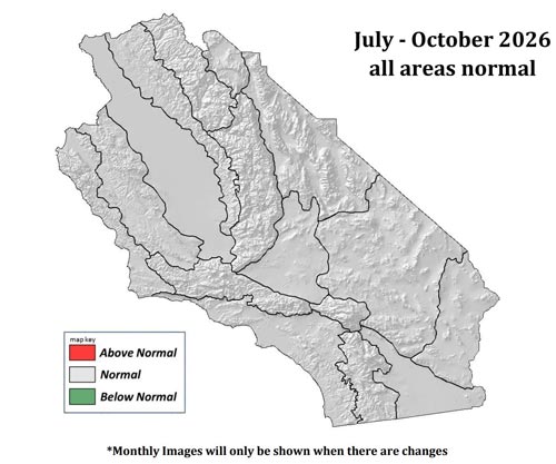
July – October 2026 South Ops Highlights
• Temperatures will likely be a little above normal through September.
• Above normal monsoonal shower and thunderstorm activity is likely starting in mid-July. In addition to traditional monsoonal activity, there is a well above normal likelihood for remnant tropical cyclone impacts on Southern California.
• Cool season wetting rains are likely to arrive before any significant offshore wind events this fall, but that may be a little beyond this outlook period
Weather Discussion
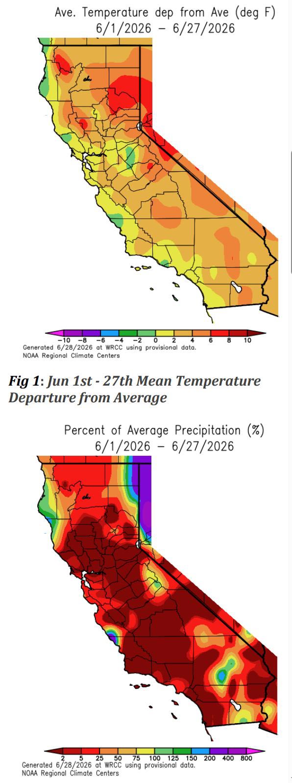
July 6, 2026 - June was a little warmer than average over the region, though positive temperature anomalies were driven more by consistent moderate warmth than any extreme heat events (Figure 1). A persistent marine influence brought more seasonable temperatures towards the coast. Precipitation was limited in June, with only isolated shower and thunderstorms in some of the mountains and deserts. Most of the region typically receives very little rain in June, rendering dry anomalies of little value (Figure 2). An anomalously deep troughing pattern developed over the Western US during the final days of June. As of the time of this outlook, this trough was producing well below normal temperatures across the region, and will eat into the positive temperature anomalies observed for the month.
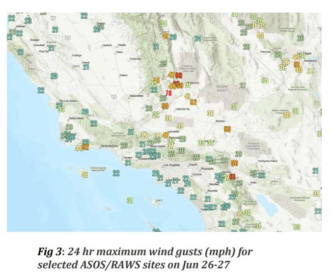
There was little in the way of significant winds for most of June, which is typical as June is beyond the traditional end of offshore wind season. Light onshore flow dominated for the most part. The deep trough which developed late in the month brought strong southwest to northwest winds across the interior of the region (Figure 3) and breezy onshore flow with a very deep marine layer in the coastal areas.
Fuels Discussion
Latest USDA Drought Monitor (Figure 4) shows very little in the way of drought over Central and Southern California, though abnormally dry conditions do exist in some areas following localized rainfall deficits this past winter and stress induced by hot temperatures this spring. Meaningful degradation in drought conditions is not expected over the coming months.
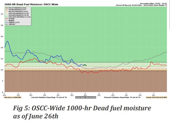
Dead fuel moisture values have been near normal over the past several weeks, with a lack of extreme weather conditions allowing gentle rises and falls which have largely tracked normal values (Figure 5). However, a more sustained pattern of above normal dead fuel moistures and below normal ERCs is now developing into early July due to the anomalous troughing pattern.
Live fuel moisture values continue to run below normal in most of the low and mid elevations. This is on account of hot conditions this past March initiating a very early end to peak growing season and the initiation of curing processes. Live fuel moisture values are more typical of early August than early July in much of the region. (Figure 6). All low and mid elevation grasses are fully cured. Higher elevation live fuel types have peaked in moisture content for the season, but remain generally unreceptive to significant fire activity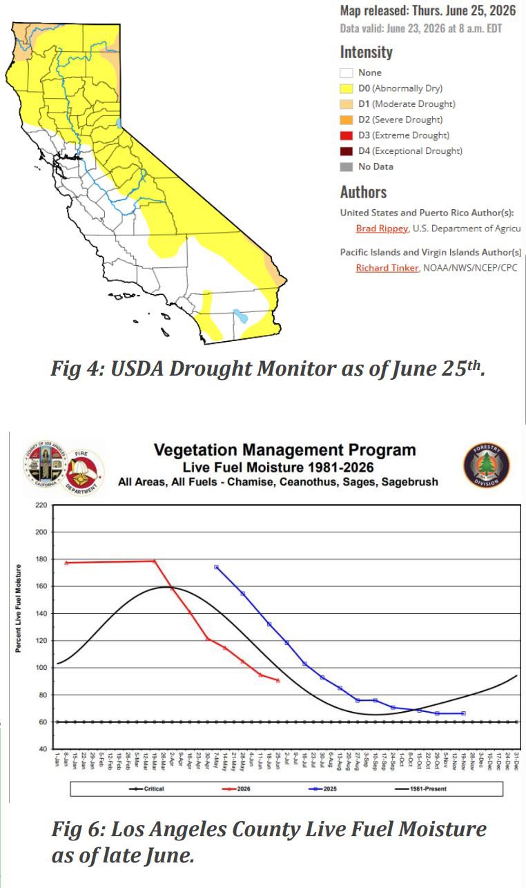
SOUTH OPS OUTLOOK
Current SST anomalies in the tropical Pacific show El Nino conditions are present (Figure 7). El Nino has rapidly developed and strengthened over the past few months, and all indications from observational data and climate models are that strong El Nino conditions will be in place later this summer and fall. Warm SST anomalies also extend from the California coast and southward, and across broad swaths of the mid-latitudes of the Pacific. But this pattern has not been enough to prevent anomalous troughing effects over the Pacific and a delayed development of the annual Four Corners/Desert Southwest subtropical ridge. Still, the warm SSTs should ultimately encourage a prevailing Western US ridging pattern and above average temperatures this summer, with that signal potentially fading towards the fall as the cool season effects of El Nino begin to emerge.
Fire activity in June was tepid relative to normal over Central and Southern California, mainly owing to the lack of extreme heat events or problematic lightning. An anomalously cool pattern will likely curtail fire activity in early July as well, typically an active month. The primary factors in favor of enhanced fire activity this summer remain the weak snowpack from this past winter and the faster than normal curing rate of most live fuels. A balance of remote sensing data and field reports indicates that fine fuel loading is near to slightly above normal in most of the region. The current SST pattern and model projections (Figure 8) favor above normal moisture over the region this summer. Climate models have favored a northerly-displaced Four Corners high, which is favorable for monsoonal activity. There is also a well above normal risk of remnant tropical cyclone activity in addition to traditional monsoon activity. While such events could bring significant lightning, the typical result of wetter than normal summers is a reduction in large fire activity over the region, though lightning-related initial attack numbers could spike. It is also likely that well above normal rainfall will occur across the region during the upcoming fall and winter, with cool season rains potentially arriving as early as October. As such, an early end to high fire season conditions is probable this fall, but that may still fall a little beyond this outlook period. For this outlook, near normal fire potential is indicated across all months for all PSAs, though if significant moisture does arrive in the coming weeks, below normal potential may be indicated in future outlooks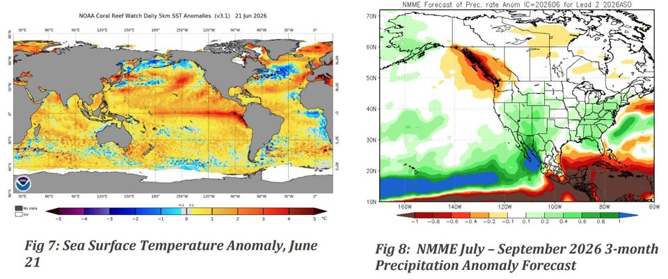
Source: Predictive Services
