


Update: Dixie Fire East Zone Evening Operations Update Video for Wednesday, August 18, 2021
Update: Dixie Fire West Zone Briefing & Community Meeting Video on Wednesday, August 18, 2021
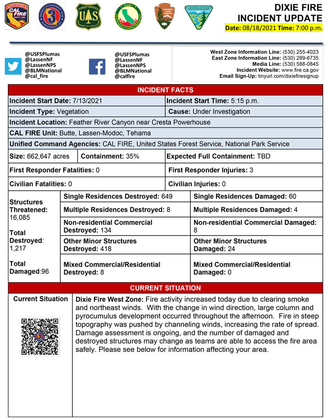
Evening Update Per CAL FIRE: California Dixie Fire is at 662,647 Acres, with 35% Containment, and 5,982 personnel assigned for Wednesday evening.
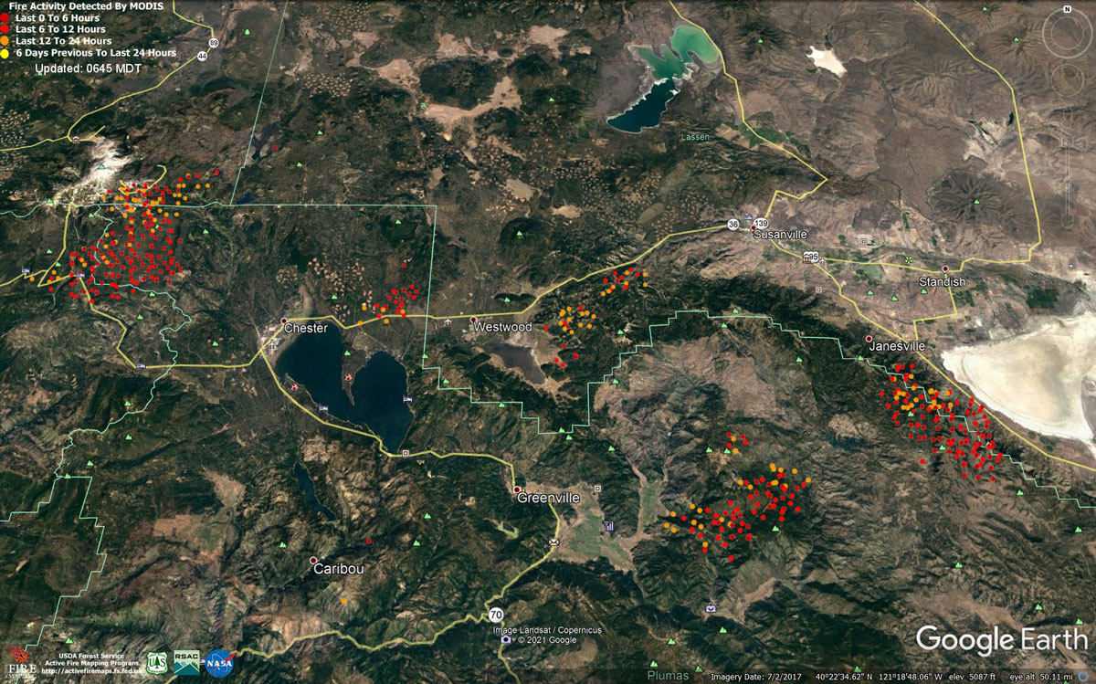
MODIS map of the Dixie Fire on Wednesday at 5:45 A.M PST
Note: 1,200 Pixels Wide - Note: Older Yellow not shown
MODIS Active Fire Mapping Program Frequently Asked Questions
Update: Dixie Fire West Zone Briefing & Community Meeting Set for 7:00 P.M. Tonight, August 18, 2021
Update: CAL FIRE California Statewide Fire Summary for August 18, 2021
Update: Plumas County Sheriff’s Office Has Issued Evacuation Warnings for the Dixie Fire
Update: Lassen County Emergency Shelter Status Update for the Dixie Fire
NEW Updates: Dixie Fire – Repopulation, Evacuation Order Reductions, and Road Openings
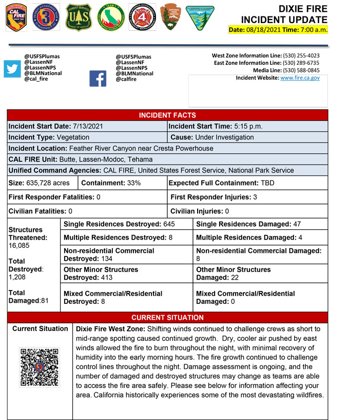
Afternoon Update Per CAL FIRE: California Dixie Fire is at 635,728 Acres, with 33% Containment for Wednesday afternoon.
Basic Information
| Current as of | 8/18/2021, 11:12:28 AM |
| Incident Type | Wildfire |
| Cause | Under Investigation |
| Date of Origin | Tuesday July 13th, 2021 approx. 05:15 PM |
| Location | Feather River Canyon near Cresta Powerhouse and Lake Almanor. |
| Incident Commander | Billy See, CALFIRE IMT 3 Jerry McGowan, CIIMT 1 Jay Lusher, NPS/BLM |
| Incident Description | Wildfire |
| Coordinates | 39.819 latitude, -121.419 longitude |
Current Situation
| Total Personnel | 6,041 |
| Size | 635,728 Acres |
| Percent of Perimeter Contained | 33% |
| Estimated Containment Date | Monday August 30th, 2021 approx. 12:00 AM |
| Fuels Involved |
Fuel moistures are historically low, ERCs and BI are in the 97-99%. Northern California remains under a Fuels and Fire Behavior Advisory |
| Significant Events |
Active: Wind Driven Runs Group Torching Short-range Spotting Narrative: Shifting winds continued to challenge crews as short to mid-range spotting caused continued growth. Dry cooler air pushed by east winds allowed the fire to burn throughout the night, with minimal recovery of humidity values into the early morning hours. The fire growth continued to challenge control lines throughout the night. Within the LNP, the wind shift resulted in the fire spread that crossed Hwy 89. |
Outlook
| Planned Actions |
Construct direct and indirect line to secure fire perimeter. Direct line construction in the Westwood area will require a heavy resource presence. Provide for service calls within communities impacted by the fire: Chester, Hwy 36 corridor, Hwy 89 Corridor, Paxton, Greenville, Jonesville, Crescent Mills, Taylorsville, Prattville, Canyon dam, Butte Meadows, Bucks Lake, Meadows Valley, Rush Creek, Warner Valley, Pecks Valley, Williams Valley, Hunt Canyon, Susanville, and the Greater Almanor area. Structure defense will continue in communities on the north end of Lake Almanor and in Warner Valley. Continue structure defense near Willow Dip at the southern end of Lassen Nat'l Park and within the Park itself. Protect threatened areas of Janesville, Indicator Peak and Loan Peak. Heavy mop and patrol of communities impacted by the fire front. "Make Safe" for repopulation. Crews in the Cradle Valley area are currently performing structure preparations in anticipation of further action in area. Structure protection continues in the Wilcox Valley region. Resources will be working from Dyer Mountain east to Mountain Meadow Reservoir utilizing direct line to complete action in that area. Holding actions from previous firing operations and point protection of communities and critical infrastructure will require a significant resource presence for the next several operational periods. Continued mop up of and patrol of 1,000-hr fuels will require a significant amount of resources due to the volume of fuels and the steep and rugged terrain. |
| Projected Incident Activity |
12 hours: Temperatures will be in the double digits today. The atmosphere will be improve in stability with a Haines of 4-5. Forecasted winds from the NE-N today. Fire behavior will consist of wind driven surface fire, isolated torching and spotting. Moderate overnight recoveries may provide opportunity for line construction and firing operations. Local thresholds will be exceeded. Expect comparable fire behavior as the previous operational period. The fire will most likely spread to the South and be topography/slope/fuel continuity driven spread. 24 hours: Moderate Risk burn environment. Temperatures will be in the high 90's today and will be similar over the next few operational periods. Fire behavior would include wind driven surface fire, group torching, crown runs with alignment and spotting. Moderate overnight recoveries may provide opportunity for line construction and firing operations. Local thresholds will be exceeded. Expect an increase in fire activity with clear air. 48 hours: Moderate Risk burn environment. Temperatures will be in the mid 90's and will be similar over the next few operational periods. 72 hours: Temperatures will be in the mid 90's over the next few shifts. Expect comparable fire behavior as the previous operational period. Forecasted hot and dry weather through the end of the week. Anticipated after 72 hours: Expect similar burning conditions. Temperatures will remain in the high 90s throughout the week |
| Remarks |
Continuation of Box 4: California Interagency Incident Management Team 1(CIIMT 1)is in command of the East Zone. East Zone Unified Command Agencies: Plumas National Forest and Lassen National Forest CAL FIRE IMT3 is in command of the West Zone. West Zone Unified Command Agencies: Bureau of Land Management, CAL FIRE, Lassen National Forest, National Park Service Continuation of Box 7: 450 acres of the total acres reported is the Morgan Fire. 0% containment. Continuation of Box 25: The fire area is in portions of Butte, Lassen, Plumas, Shasta, and Tehama counties. Active fronts are in the Greater Lake Almanor area, Lassen NF, and Lassen NP, as well as on several private timber ownerships. Continuation of Box 31(J): Civilians in indoor temporary shelters - 94 Civilians in outdoor temporary shelters - 260 Continuation of Box 32(E): East Zone - 1 responder injury West Zone - 2 responder injuries Continuation of Box 38: Additional threatened values at risk include: Bizz Johnson National Recreation Trail Continuation of Box 48: Resource count reduced due to reconciliation of assigned resources between East and West Zones. |
Current Weather
| Weather Concerns |
EAST ZONE: A cold front passed over the east zone of the fire early last night around 2100 causing a shift in winds to the northwest. Winds worked their way to the northeast round midnight. After an initial drop in RH from the front, moderate recoveries ere experienced overnight. Low temperatures fell well below seasonal averages behind the front. Northeasterly winds are expected to persist today with gusts round 15 to 20 mph in the afternoon. RH values are expected to fall to the upper teens and mid-twenties by late afternoon with highs in the mid 70's to mid 50's. West Zone: A dry cold front moved across the incident tonight shifting winds to the NW and eventually to the NE. Winds remained elevated at 10 to 20 mph. Temperatures remained in the 70's by late evening. Humidity only recovered into the lower to mid-20s. |
Update: Dixie Fire – Repopulation, Evacuation Order Reductions, and Road Openings
Update: Dixie Fire East Zone Operations Morning Briefing Video for Wednesday, August 18, 2021
Update: Dixie Fire West Zone Operations Morning Briefing Video for Wednesday, August 18, 2021
Update: Smoke/Air Quality Outlook for the Dixie Fire in the Eastern Sierra for Wednesday, August 18Update: Dixie Fire Morning Briefing Video for Wednesday, August 18, 2021
August 18, 2021 - Dixie Fire is 635,728 acres and 33% contained for Wednesday morning.Update 7:20 A.M. CAL FIRE
Click here for: California Dixie Fire Tuesday, August 17, 2021 Updates
