


Click here for Thursday's Infrared Map: California Caldor Fire Infrared Map for Thursday, August 26, 2021 - Interpreted Acreage: 136,643
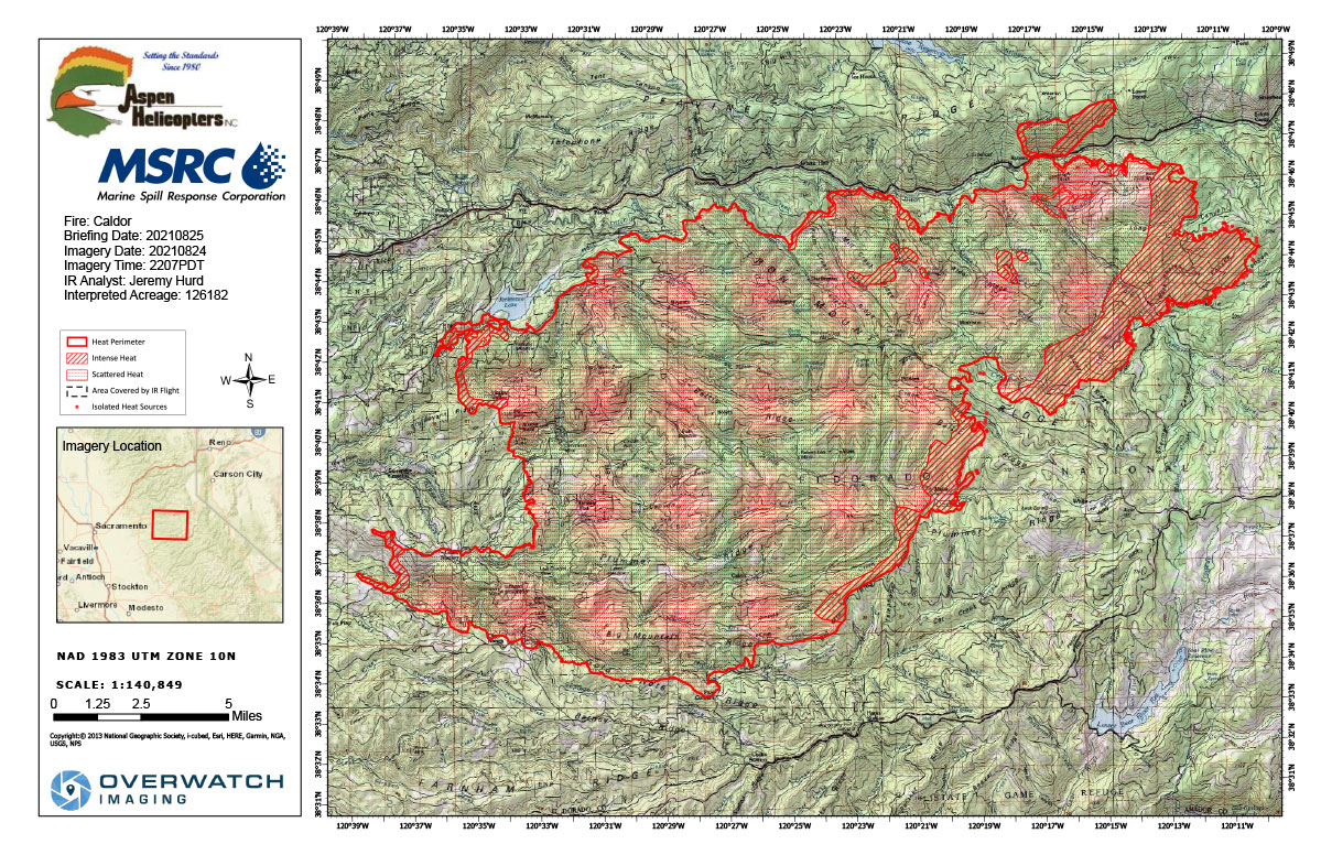
Flight Notes: Interpreted Acreage: 126,182 a Growth of 8,478 acres from last periodScattered heat remains throughout the entire incident. Significant growth to the north and NNE. Southern perimeter shows no sign of growth. Intense heat remains around the west, north, and east perimeters.
Note: Map is 1,200 pixels wide
Wednesday, August 25, 2021 - Above Map is the Caldor Fire Infrared Map for Today with Flight Notes.Click Here for: California Caldor Fire Wednesday, August 25, 2021 Updates
