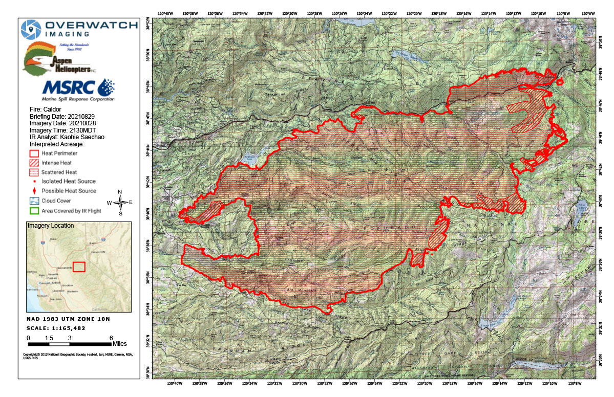
Flight Notes: Interpreted Acreage: -- a Growth of -- acres from last period
Smoke plume extending above 14k on North side, we will have to fly around 1945 Had to avoid smoke plume at the northern side of CALDOR 2013 Were able to go back and fly area avoided earlier due to smoke plume. Fire perimeter continues to extend eastward and SSE, minor growth to the NNW peninsula with intense heat in those areas. Intense heat around the eastern perimeter extending to the south.
Note: Map is 1,200 pixels wide
Click here for Monday's Infrared Map:
California Caldor Fire Infrared Map for Monday, August 30, 2021
Click Here for: California Caldor Fire Sunday, August 29, 2021 Updates


