


May 14, 2019 - The National Weather Service Hanford Office reports a storm system will impact Central California starting late Wednesday through early Friday.
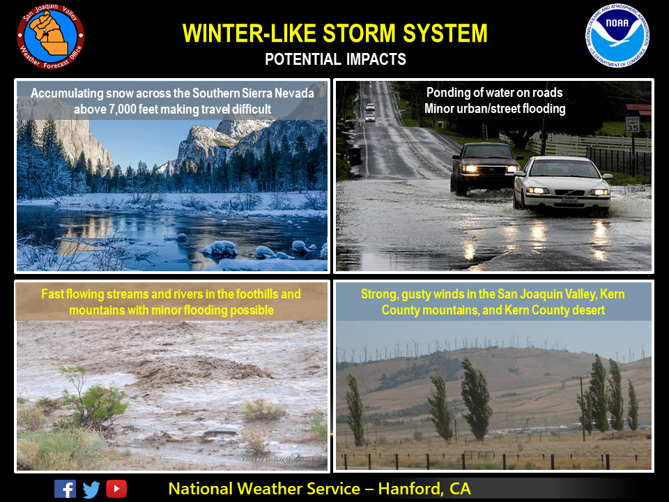
Light to moderate snow could fall across the Central and Southern Sierra Nevada above 7,000 feet, especially early Thursday morning.
Moderate rainfall rates are possible in the Mariposa, Madera, and Fresno County foothills Wednesday night through Thursday morning, resulting in the possible threat of mudslides, rockslides, and debris flow flooding, particularly in recently burned areas, such as the Ferguson burn scar in Mariposa County.
Across the San Joaquin Valley, ponding of water on roadways may result in minor urban and street flooding.
Winds may become an issue for the favored areas of Kern County during frontal passage late Wednesday night to early Thursday morning.
  Area Forecast Discussion
  National Weather Service San Joaquin Valley - Hanford CA
  336 AM PDT Tue May 14 2019

  .SYNOPSIS...
  High pressure will remain over the forecast area before an area
  of low pressure moves into the region late Wednesday and continues
  through Thursday night. A series of storm systems arriving on
  Saturday night and continue through Tuesday will bring unsettled
  wet weather to the region.

  &&

  .DISCUSSION...
  One more day of nice weather before we get a flashback of winter
  to the region. Storm system in the EPAC will swing a cold front
  through the region starting Wednesday afternoon and evening.
  Impressive moisture flux with the front will bring in impressive
  QPF across the region into Thursday. Post frontal environment
  will be very favorable for afternoon and evening thunderstorms on
  Thursday. We have issued a Winter Storm Watch for the Sierra for
  Wednesday night through Friday morning for heavy snow above 5000
  feet and very heavy snow above 8000 feet. Snow levels will start
  out around 8000 feet Wednesday afternoon and lower to around 5000
  feet by Thursday afternoon and continue as the system ends on
  Friday. Current guidance is forecasting up to 2 feet of snow above
  5000 feet and isolated amounts of up to 3 feet above 8000 feet
  with the event.

  Models have been advertising this system for several days and the
  guidance is consistent with previous runs. The low will move
  inland on Friday and weak ridging will build in on Friday and
  Saturday with clearing skies and slightly warmer temps from
  Thursday. Another system will be on its heels as precipitation
  will return to the area by Saturday evening and continue through
  Tuesday as a series of disturbances will move quickly through the
  zonal onshore flow over the region. Exact timing and intensity is
  still a bit uncertain for the mid week event. More heavy snow is
  expected with the prolonged event and lower elevation rain will
  be quite impressive as well across the Sierra foothills and in
  parts of the SJV.
Source: NWS

