


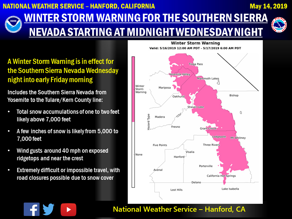
May 15, 2019 - The National Weather Service Hanford Office reports a Winter Storm Warning is in effect for the Southern Sierra Nevada from Midnight Wednesday night until 6:00 A.M. Friday morning.
Snow levels will start at around 8,000 feet Wednesday night, before falling to about 5,000 feet Thursday afternoon.
The heaviest snowfall is expected Wednesday night and Thursday morning.
Motorists should anticipate lengthy delays and slick, hazardous road conditions, as well as the potential for road closures.
If you plan to travel, consider alternate strategies.
If you must travel, remember to carry tire chains, plenty of food, a good deal of water, and warm clothing in your vehicle.
For information on road conditions, including closures or delays, call Caltrans at 1-800-427-7623 or visit http://www.dot.ca.gov/cgi-bin/roads.cgi.
Winter Storm Warning
URGENT - WINTER WEATHER MESSAGE
National Weather Service Hanford CA
1114 PM PDT Tue May 14 2019

Central Sierra-North Kings River-Sequoia Kings-
Including the cities of Devils Postpile, Florence Lake,
Lake Thomas Edison, Tuolumne Meadows, Fish Camp, Shaver Lake,
Camp Nelson, Giant Forest, Lodgepole, and Grant Grove
1114 PM PDT Tue May 14 2019

...WINTER STORM WARNING REMAINS IN EFFECT FROM MIDNIGHT WEDNESDAY
NIGHT TO 6 AM PDT FRIDAY ABOVE 5000 FEET...

* WHAT...Heavy snow expected above 5000 feet. Total snow
  accumulation of up to 21 inches expected. Winds gusting as
  high as 40 mph.

* WHERE...Central Sierra, North Kings River and Sequoia Kings.

* WHEN...From midnight Wednesday night to 6 AM PDT Friday.

* ADDITIONAL DETAILS...Travel could be very difficult to
  impossible. The hazardous conditions could impact the morning
  or evening commute.

PRECAUTIONARY/PREPAREDNESS ACTIONS...

A Winter Storm Warning for snow means severe winter weather
conditions will make travel very hazardous or impossible. If you
must travel, keep an extra flashlight, food and water in your
vehicle in case of an emergency.

The latest road conditions for the state you are calling from can
be obtained by calling 5 1 1.
Source: NWS

