


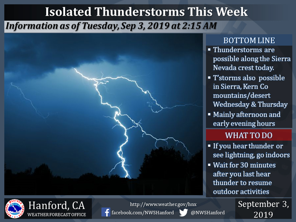
September 3, 2019 - The National Weather Service Hanford Office reports isolated thunderstorms are possible in the Southern Sierra Nevada, mainly along the crest, today during the afternoon and early evening hours.
Chances of afternoon/evening thunderstorms continue on Wednesday and Thursday in the Sierra Nevada, as well as the Kern County mountains and desert.
Frequent dangerous lightning, small hail, and wind gusts near 40 miles per hour are some of the hazards associated with strong thunderstorms.
In addition to these hazards, any thunderstorm can produce intense rainfall rates that lead to localized flooding.
  Area Forecast Discussion
  National Weather Service Hanford CA
  238 AM PDT Tue Sep 3 2019

  .SYNOPSIS...
  A few strong thunderstorms may impact the Southern Sierra Nevada,
  Kern County mountains, and Kern County desert each afternoon and
  early evening from today through Thursday. High temperatures
  today through Thursday will be five to eight degrees above normal
  for this time of year. A cooling trend is expected this weekend.

  &&

  .DISCUSSION...
  An upper-level area of high pressure near the Four Corners will
  slowly move eastward today through Thursday. Farther west, a
  trough of low pressure aloft will remain just offshore of the west
  coast of the United States today through Thursday. Southerly flow
  between these two atmospheric features will continue to inject
  monsoonal moisture northward into Central California today
  through Thursday. A few strong thunderstorms could impact the
  Southern Sierra Nevada, Kern County mountains, and Kern County
  desert each afternoon and early evening from today through
  Thursday. The most intense thunderstorms will produce heavy
  rainfall, wind gusts near 45 mph, and half inch hail. Maximum
  temperatures across Central California today through Thursday will
  be five to eight degrees above normal for this time of year.

  The aforementioned upper-level trough of low pressure will move
  inland over the Pacific Northwest Thursday night. This trough of
  low pressure aloft will progress northeastward across the Pacific
  Northwest Friday. An upper-level area of low pressure will
  approach the west coast of the United States Friday night and
  Saturday. This area of low pressure aloft should move inland over
  Northern California Saturday night. The upper-level area of low
  pressure will quickly progress northeastward into Southern Idaho
  Sunday. Another area of low pressure aloft may approach the
  Pacific Northwest Sunday night and Monday. A rather significant
  cooling trend will begin Friday and persist through the upcoming
  weekend. By Sunday afternoon, high temperatures throughout Central
  California will be around five degrees below normal for this time
  of year.
Source: NWS

