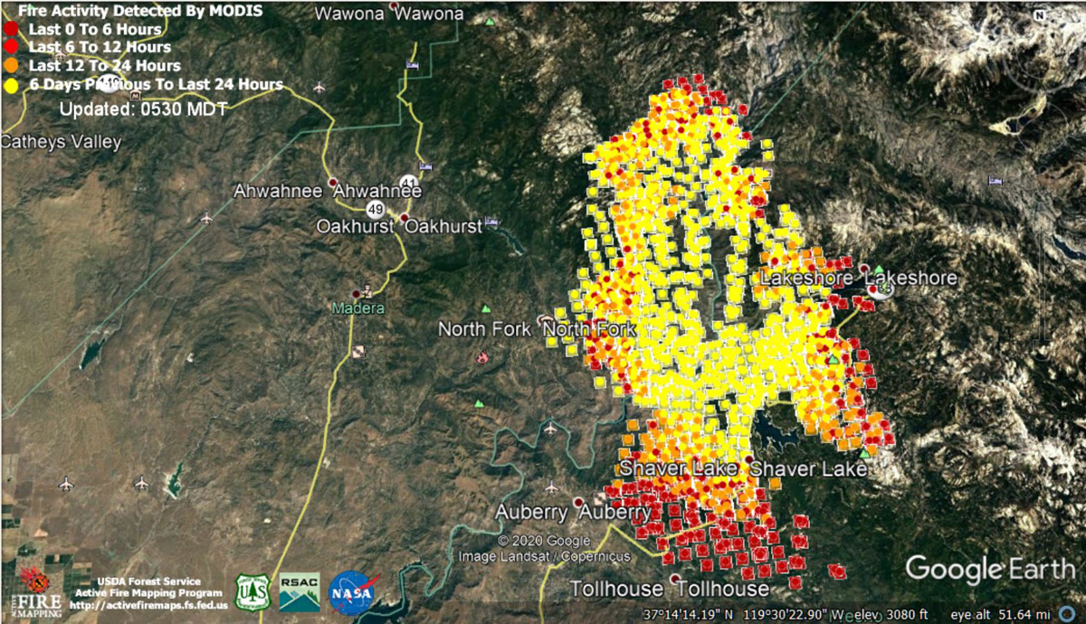
MODIS Active Fire Mapping Program Frequently Asked Questions
Update 10:40 P.M. Per CAL FIRE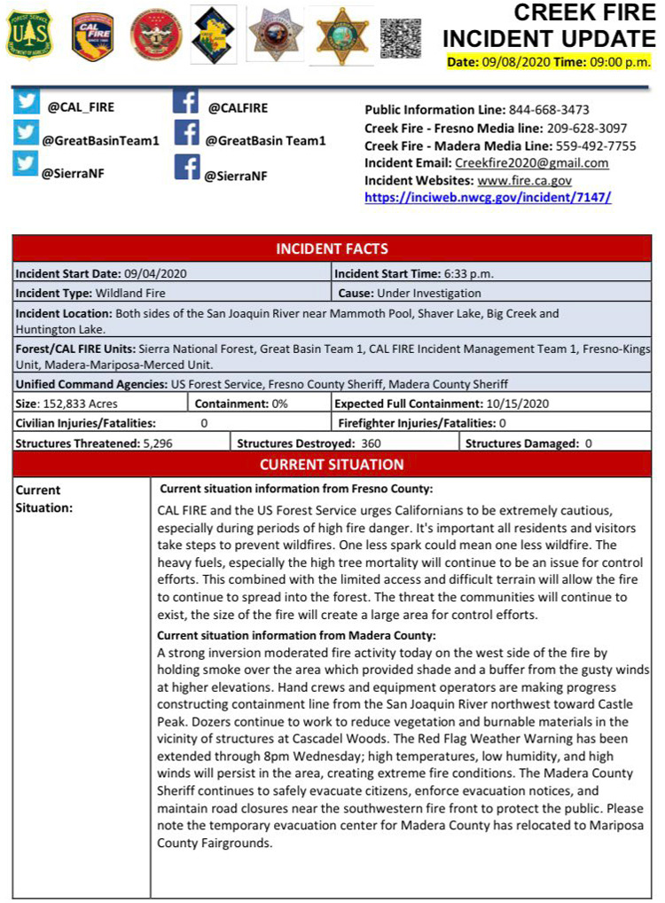
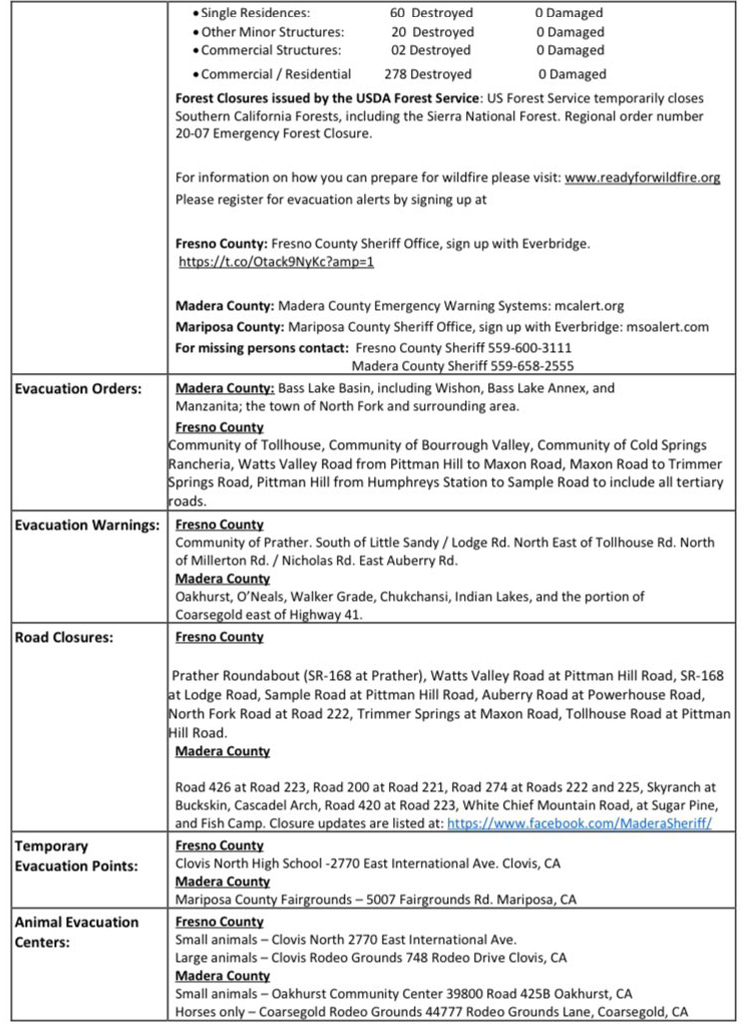
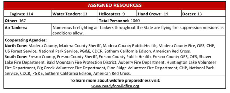
Update 9:30 P.M. Per CAL FIRE: Creek Fire Northeast of Shaver Lake in Fresno County is 152,833 acres.
Update 9:00 P.M. Per Fresno County Sheriff’s Office: We have put together a detailed map of the Creek Fire. Click the link (here) to view our latest version. We will work to make alterations and improvements as we move forward.
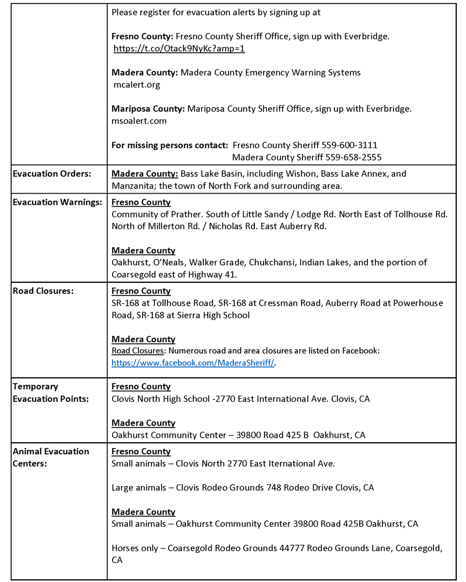
Update 7:15 P.M. Per California Red Cross: The Temporary Evacuation Point at Oakhurst Community Center has closed. The NEW Evacuation Point is located at Mariposa County Fairgrounds. Clovis North High School remains open
NEW: Mariposa County Fairgrounds
Clovis North High School
We do everything we can to avoid having to relocate shelters and hotels, but sometimes it’s unavoidable. Disaster require flexibility and the safety of others is our number one priority
Update 4:35 P.M. Yosemite National Park Service to Host a Creek Fire Community Meeting Today, Tuesday, September 8 at 6:00 P.M. at the Wawona Community Center
Update 4:35 P.M. CAL FIRE: Evacuation Update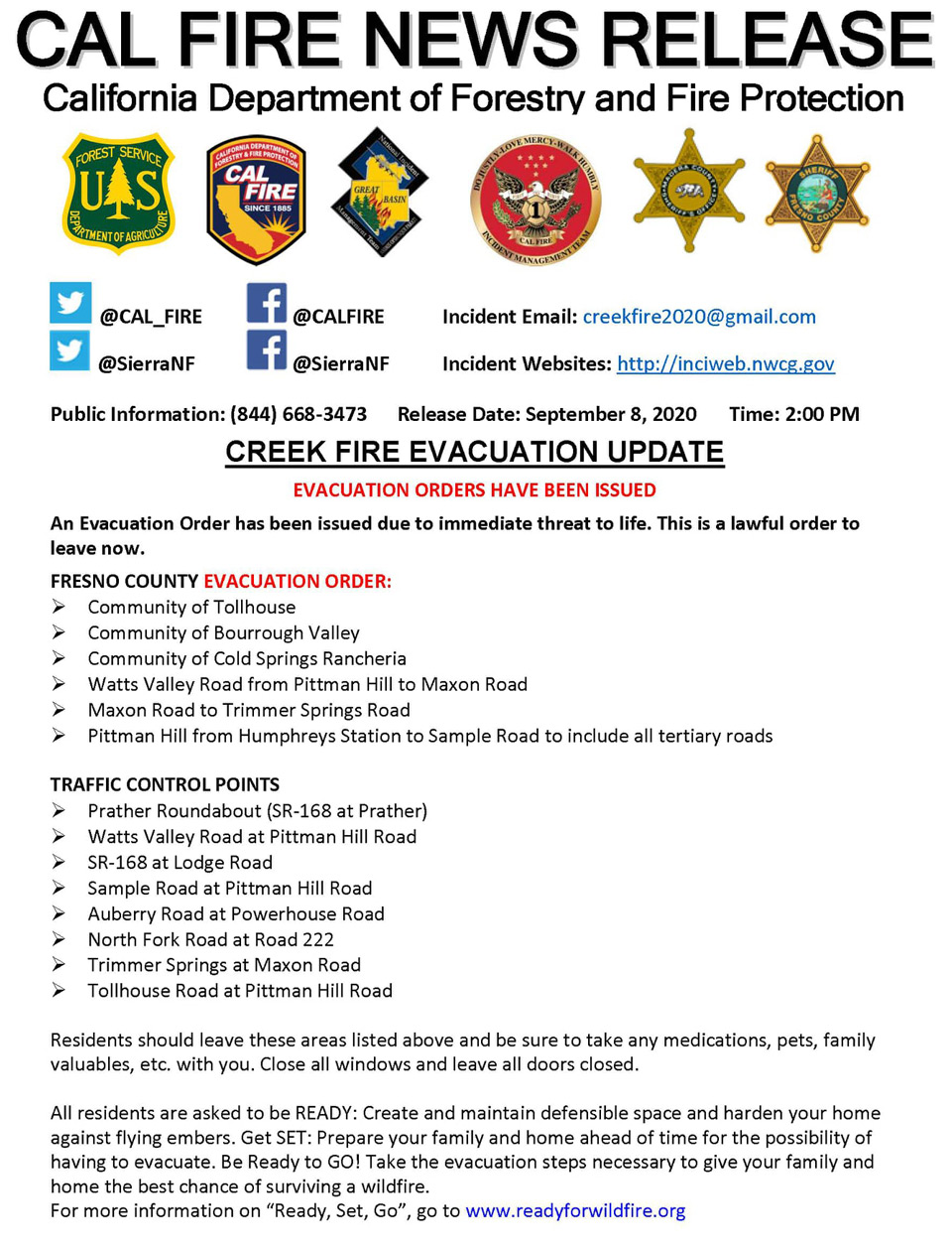
Update 4:20 P.M.: Weather Service Reports Creek Fire Danger this Evening and Tonight With Possible Wind Gusts Near 30 MPH at Shaver Lake
Update 3:50 P.M. Per Fresno County Sheriff’s Office: The following are the newest Evacuation Orders put into effect for the Creek Fire:
- Humphrey’s Station to Tollhouse Road.
- Humphrey’s Station to Pittman Hill Road to Sample Road
Update 2:50 P.M. Forest Service Wildland Fire Smoke/Air Quality Outlook Due to the Creek Fire in the Yosemite Area for September 8 & 9, 2020
Update 2:35 P.M. Sierra National Forest to Hold a Livestream Incident Briefing with CAL FIRE for the Creek Fire Tonight (Tuesday) at 7:00 P.M.
Update 1:25 P.M. CAL FIRE Statewide Fire Update Video for Tuesday, September 8, 2020 - Creek Fire Information Included
Update 11:43 A.M. Fresno County Sheriff's Office:
Motorists should be aware of the following road closures due to the CreekFire:
- Pittman Hill Road / Tollhouse Road
- Pittman Hill Road / Sample Road
- Pittman Hill Road / Watts Valley Road
- Maxon Road / Trimmer Springs Road
- Hwy. 168 at the roundabout in Prather
Update 11:10 A.M.: Congressman Tom McClintock Announces FEMA - Fire Management Assistance Granted for the Creek Fire in Madera and Fresno Counties
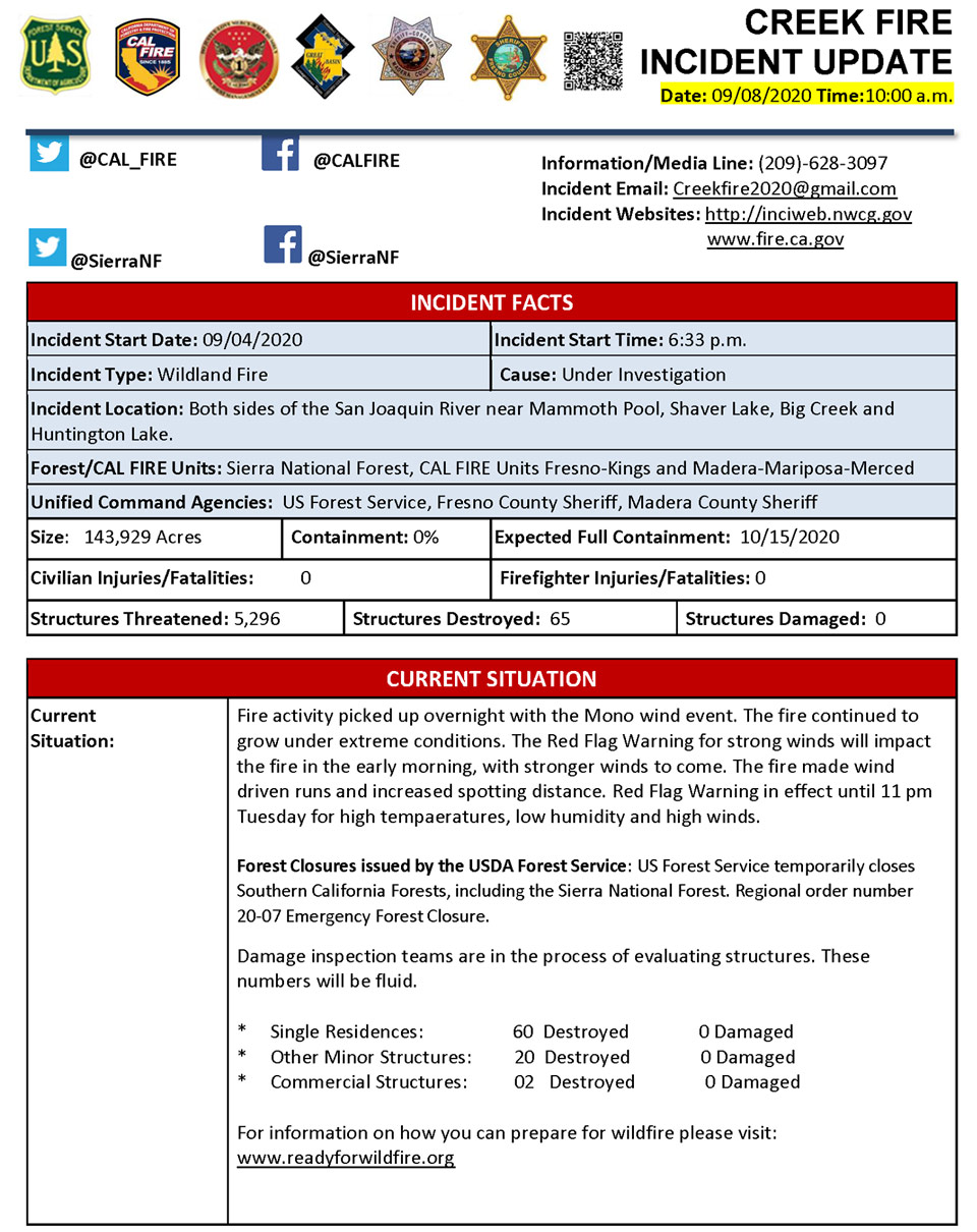
Update 10:50 A.M.: CAL FIRE - Structures Threatened: 5,296 - Structures Destroyed: 65
Update 10:25 A.M.: Weather Service Red Flag Warning for the Sierra Nevada Mountains and Foothills Including Mariposa, Oakhurst and Yosemite Extended Until Wednesday Evening
Update 8:53 A.M. Fresno County Sheriff's Office:
The following Evacuation Orders are now in effect for the #CreekFire.
- Sycamore Road and Burrough Valley.
-Watts Valley from Maxon Road to Pittman Hill Road.
-Maxon Road to Trimmer Springs Road.
An Evacuation Order means there is immediate threat to life. This is a lawful order to leave now. The area is lawfully closed to public access.
Update 8:40 A.M. Per InciWeb: 143,929 Acres
Extreme, Crowning, wind driven runs Long range spotting. The fire continues to grow under extreme conditions. The fire has had strong winds with upper level winds from the northwest and variable lower level winds. The fire continued to grow in all directions with large increases to the south and east. The progression has threatened new communities in the foothills, especially with the winds predicted for today. Extreme fire behavior is still being observed with the critical fuels and weather. Evacuations and Road Closures. Hwy 168 is closed.
September 8, 2020 -
Bureau of Land Management Temporarily Closes Recreation Area Due to Creek Fire
Monday Information: As of Monday evening: 135,523 Acres Acres with 0% Containment
Sierra National Forest Creek Fire Updates for Monday, September 7, 2020


