


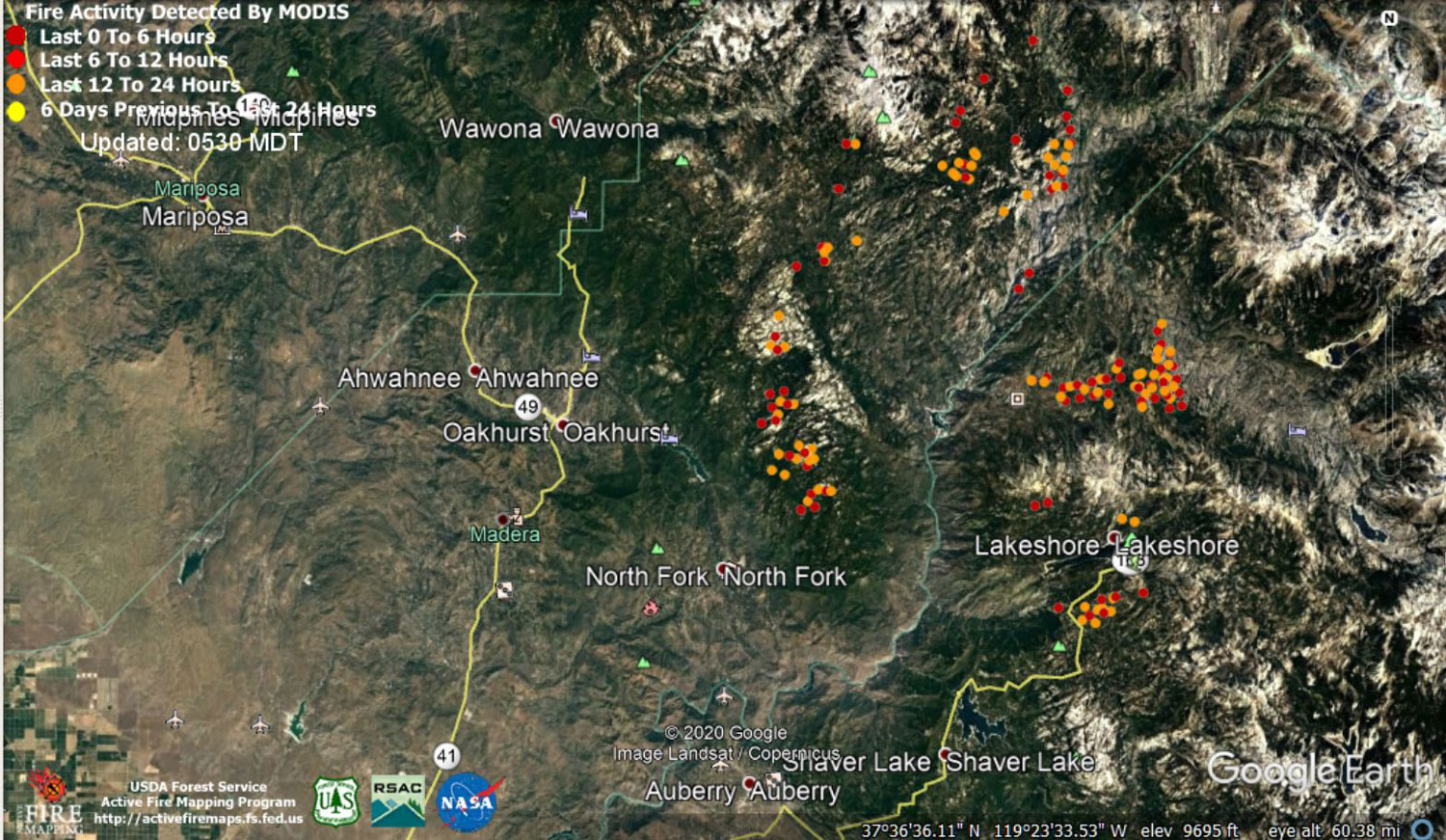
 MODIS map of the Creek Fire on Monday at 4:30 A.M. PST
Note: 1,500 Wide and older yellow detections removed
MODIS Active Fire Mapping Program Frequently Asked Questions
Update 7:00 P.M. CAL FIRE Evening Update: The Creek Fire is now at 280,425 acres with 30% containment.
'Click' here to view 13 page PDF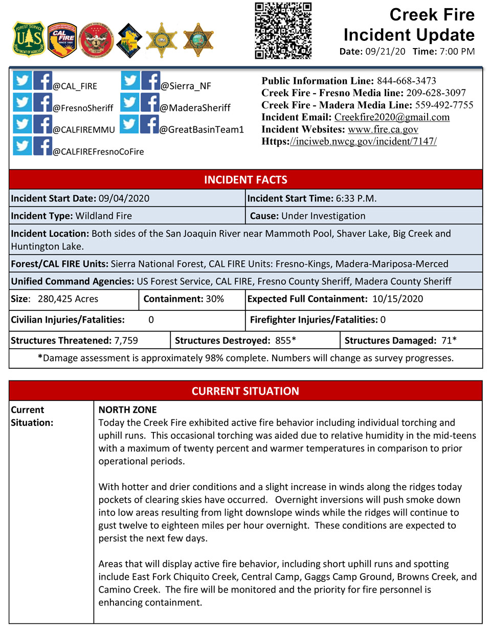
Update 5:20 P.M. PG&E Continues to Make Repairs Following Creek Fire Damage - 850 Customers Remain Out Due to Fire Damage
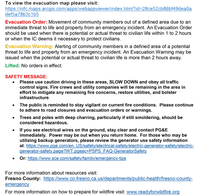
Update 2:10 P.M. Per CAL FIRE: Evacuation Warnings Lifted on the Creek Fire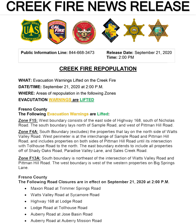
Update 1:40 P.M. Per Madera County Sheriff’s Office: Evacuation Warnings Lifted for M2, M3, M4A, M5, M6, M7, M15, M16, M18, M19 & M31
The Madera County Sheriff's Office is pleased to announce the Evacuation Warnings for the following Evacuation Zones have been lifted. M1 Kerckhoff Lake, M2 Corrine Lake Road, M3 Lark Lane, M4A Redinger Lake Area, M5 Rainbow Drive, M6 Lower Cascadel Road, M7 Cascadel Area, M15 Carmen Ranch Road, M16 Road 222, M15 Road 222, M18 Road 222, M19 Road 228, and M31: Forest Service North Fork Station.
Update 11:40 A.M.: Sierra National Forest Creek Fire North Zone Operations Briefing Video For Monday, September 21, 2020
Update 10:50 A.M.: Forest Service Wildland Fire Smoke/Air Quality Outlook Due to the Creek Fire in the Yosemite Area for September 21 & 22, 2020
Update 10:07 A.M.: Sierra National Forest Creek Fire Operations South Zone Briefing Video for Monday, September 21, 2020
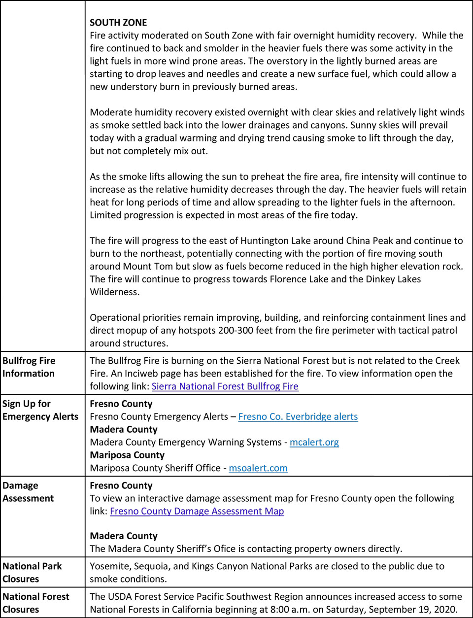
Update 7:45 A.M.: CAL FIRE morning update: 278,368 acres and 27% containment, with 8,063 structures threatened.
'Click' here to view 14 page PDF With Evacuations
Update 6:30 A.M.: Sierra National Forest Creek Fire Operations Map for Monday, September 21, 2020 - Shows Divisions, Uncontrolled Fire Edge, Completed Dozer Lines, Proposed Dozer Lines
Update 5:35 A.M.: Sierra National Forest Creek Fire Public Information Map for Monday, September 21, 2020 - Shows Fire Perimeter and Containment
September 21, 2020 - Overnight infrared mapping has the Creek Fire at 277,421 Interpreted Acres.
Comments and notes on flight:
No data was received for the central portion of the fire. The perimeter in that area is indicated as estimated.
Areas of growth with intense fire were detected along the northwestern, northern, and northeastern perimeters of the fire.
Additional areas of intense fire were detected within the northern portion of the perimeter.
Extremely large areas of scattered fire essentially filled the northern portion of the perimeter.
Isolated fires were generally within fairly close proximity to the main perimeters.
A few isolated fires were detected at greater distances from the northeastern end of the fire.
Note - Due to GIS system differences, the estimated acreage is smaller than the acreage number in the attribute table of the starting perimeter, even though growth occurred at the fire.
Sunday Evening Update: 278,368 acres and 27% containment.
Sierra National Forest Creek Fire Updates for Sunday, September 20, 2020
