


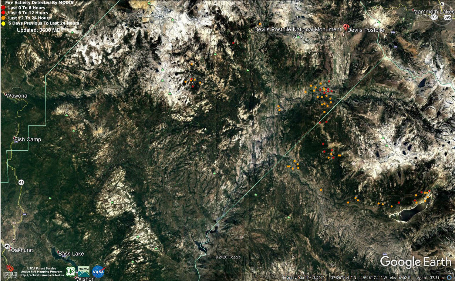
MODIS map of the Creek Fire on Wednesday at 5:00 A.M. PST
Note: 1,500 Wide and older yellow detections removed
MODIS Active Fire Mapping Program Frequently Asked Questions
Update 7:00 P.M. (LIVE): Sierra National Forest to Hold a Creek Fire Livestream Incident Briefing with CAL FIRE on Wednesday, October 28, 2020
Update 3:35 P.M.: USFS Gives a Closer Look at Geographic Information Systems on the Creek Fire with a New Video
Update 11:30 A.M. Reminder for Tonight: Sierra National Forest to Hold a Creek Fire Livestream Incident Briefing with CAL FIRE on Wednesday, October 28, 2020
Update 10:05 A.M.: Sierra National Forest Creek Fire Operations Briefing Video for Wednesday Morning, October 28, 2020
Update 9:40 A.M.: Forest Service Wildland Fire Smoke/Air Quality Outlook Due to the Creek Fire in the Yosemite Area for October 28 & 29, 2020
Update 8:15 A.M.: CAL FIRE Morning Update for the Creek Fire: 378,701 acres and 63% containment.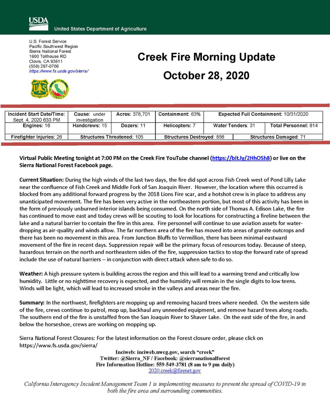
Update 5:50 A.M.: Sierra National Forest Creek Fire Public Information Map for Wednesday, October 28, 2020 - Shows Contained Line and Uncontrolled Fire Edge
October 28, 2020 - Overnight infrared mapping has the Creek Fire at 378,701 Interpreted Acres.
Comments and notes on flight:
Updated Peremeter was used when data products where generated
Tuesday Evening Update: 374,466 acres and 63% containment.
Sierra National Forest Creek Fire Updates for Tuesday, October 27, 2020

