


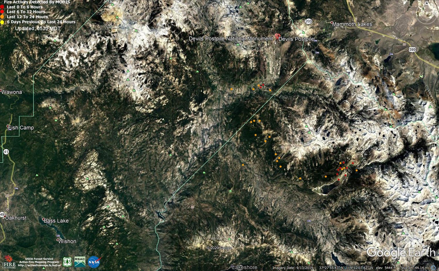
MODIS map of the Creek Fire on Thursday at 4:30 A.M. PST
Note: 1,500 Wide and older yellow detections removed
MODIS Active Fire Mapping Program Frequently Asked Questions
Update: Sierra National Forest Creek Fire Operations Briefing Video for Thursday Evening, October 29, 2020
Note this is for Thursday Evening and was released on Friday morning.
Update 10:55 A.M.: Sierra National Forest Creek Fire Operations Briefing Video for Thursday Morning, October 29, 2020
Update 9:15 A.M.: Forest Service Wildland Fire Smoke/Air Quality Outlook Due to the Creek Fire in the Yosemite Area for October 29 & 30, 2020
Update 8:15 A.M.: CAL FIRE Morning Update for the Creek Fire: 379,571 acres and 70% containment.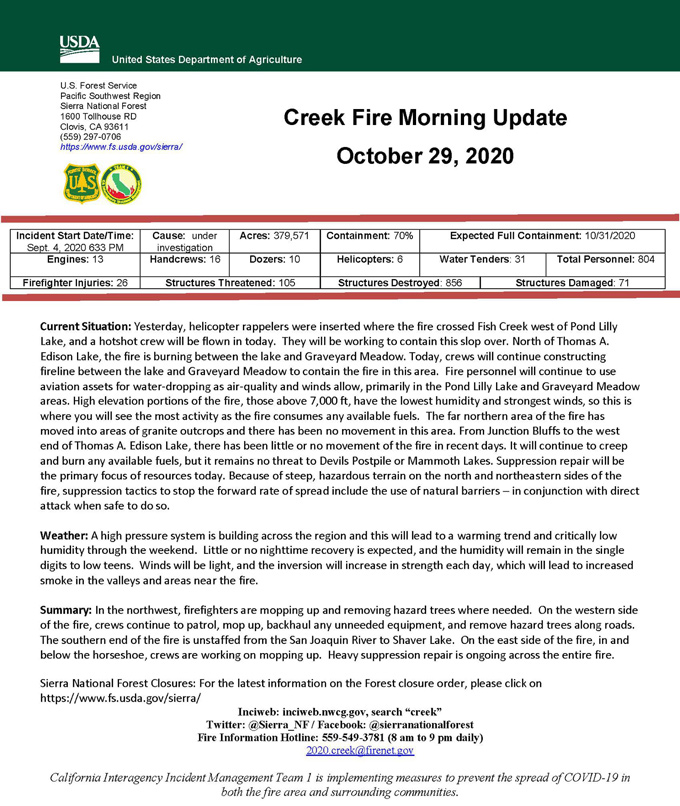
Update 5:45 A.M.: Sierra National Forest Creek Fire Public Information Map for Thursday, October 29, 2020 - Shows Contained Line and Uncontrolled Fire Edge
October 29, 2020 - Overnight infrared mapping has the Creek Fire at 379,571 Interpreted Acres.
Comments and notes on flight:
Intense heat was very little along various portions of the northeastern perimeter. Highest resolution images were used in an effort to pinpoint any heat, specifically any isolated heat near the perimeter. Used yesterday’s NIROPS perimeter as per my conversation with SITL.
Wednesday Evening Update: 378,701 acres and 63% containment.
Sierra National Forest Creek Fire Updates for Wednesday, October 28, 2020

