


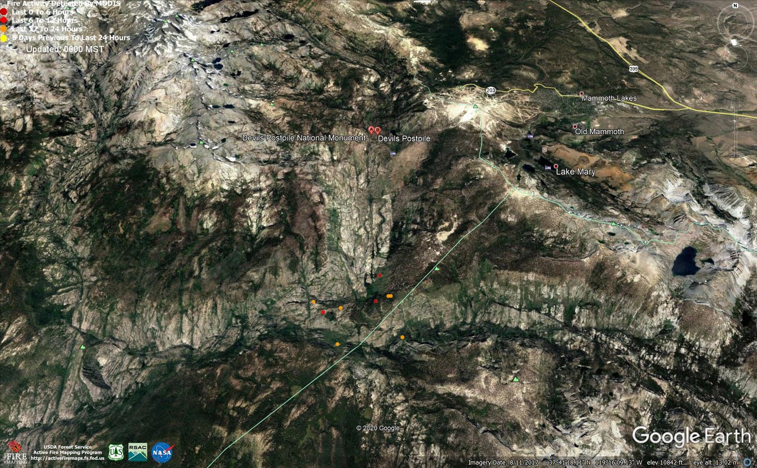
MODIS map of the Creek Fire on Thursday at 5:00 A.M. PST
Note: 1,500 Wide and older yellow detections removed
MODIS Active Fire Mapping Program Frequently Asked Questions
Update 10:50 A.M.: Sierra National Forest Creek Fire Operations Briefing Video for Thursday, November 5, 2020
Update 9:55 A.M.: Forest Service Wildland Fire Smoke/Air Quality Outlook Due to the Creek Fire in the Yosemite Area for November 5 & 6, 2020
Update 7:20 A.M.: Sierra National Forest Morning Update for the Creek Fire: 379,335 acres and 70% containment.
Update 5:50 A.M.: Sierra National Forest Creek Fire Public Information Map for Thursday, November 5, 2020 - Shows Contained Line and Uncontrolled Fire Edge
November 5, 2020 - Overnight infrared mapping has the Creek Fire at 381,985 Interpreted Acres.
Comments and notes on flight:
Tonight, we flew only the Northern half of the Creek fire perimeter and collected LWIR imagery. Heat Perimeter from 20201104 NIROPS products was used to generate tonight’s NIROPS products. For heat detection and perimeter updating we used 16-bit LWIR imagery only.
The most active heat and perimeter growth is in the East and Northeast. The northern edge going to the west is also active and growing but not as much. I closed 4 coves, all on the North East side. Today’s perimeter growth value is smaller than yesterdays.
Wednesday Evening Update: 378,730 acres and 70% containment.
Sierra National Forest Creek Fire Updates for Wednesday, November 4, 2020

