


Creek Fire Infrared Map for Sunday
Note: 1,500 wide
Click Here for Large Map (901K)
MODIS map of the Creek Fire on Sunday at 4:30 A.M. PST shows no detected footprints
MODIS Active Fire Mapping Program Frequently Asked Questions
Update 10:35 P.M.: U.S. Forest Service Reports the Weather on Sunday has the Creek Fire Down, but Not Out
Update 5:55 P.M.: U.S. Forest Service Talks with Hotshot Crew About Working on the Creek Fire (Video)
Update 3:15 P.M.: Sierra National Forest to Hold a Creek Fire Livestream Incident Briefing with CAL FIRE on Monday, November 9, 2020
Update 10:25 A.M.: Sierra National Forest Creek Fire Operations Briefing Video for Sunday, November 8, 2020
Update 9:15 A.M.: Sierra National Forest Morning Update for the Creek Fire: 379,729 acres and 70% containment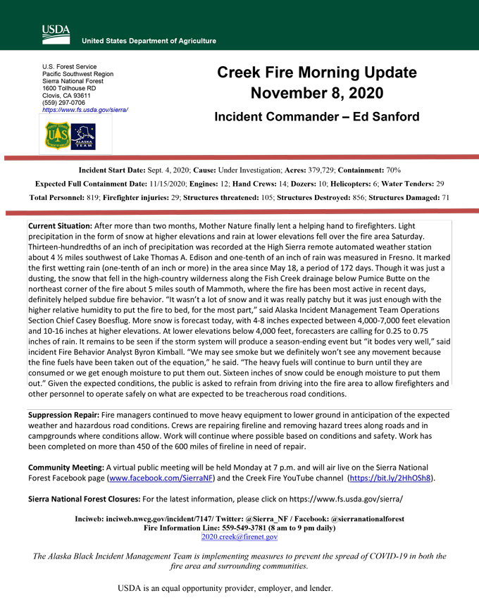
Update 8:30 A.M.: Forest Service Wildland Fire Smoke/Air Quality Outlook Due to the Creek Fire in the Yosemite Area for November 8 & 9, 2020
Update 5:50 A.M.: Sierra National Forest Creek Fire Public Information Map for Sunday, November 8, 2020 - Shows Contained Line and Uncontrolled Fire Edge
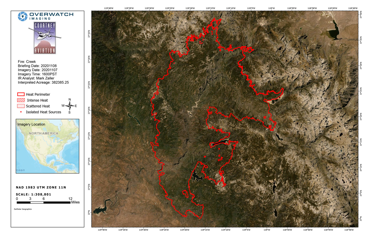
November 8, 2020 - Overnight infrared mapping has the Creek Fire at 382,385 Interpreted Acres. Plus 15 Acres * ( See Comments)
Comments and notes on flight:
Because of the winter storm we flew earlier in the daylight in hopes of capturing something. We were able to capture a surprising amount of heat through thin areas of clouds, but popssibly up to half of the fire was clouded over. Captured only the North half as usual.
Used NIROPS IR perimeter from 20201106 as the base.
All of the areas we could see were also covered with snow.
* Fire perimeter increased slightly in the North East. It may have increased in other areas but we could not see it.
Saturday Evening Update: 379,716 acres and 70% containment.
Sierra National Forest Creek Fire Updates for Saturday, November 7, 2020

