Click Here For Older Information: Fire in Yosemite National Park on Sunday, September 7, 2014
Update: 12:24 P.M.
Meadow Fire MODIS & AVHRR Fire Detections 12:30 MDT Sep. 08, 2014 with NPS fire map September 7, 2014
Joe Coho "Meadow Fire MODIS & AVHRR Fire Detections 1230 MDT Sep 08 2014 with NPS fire map for the Meadow fire dated Sep 7 2014.
The fire boundary shown on the NPS map is consistent with photos taken of the area, and also with the Yosemite Conservancy webcam on Sentinel Dome.
Also shown is the location of the small 19 acre Meadow Fire as of Sep 4 2014."
Thanks to Joe Coho for the map.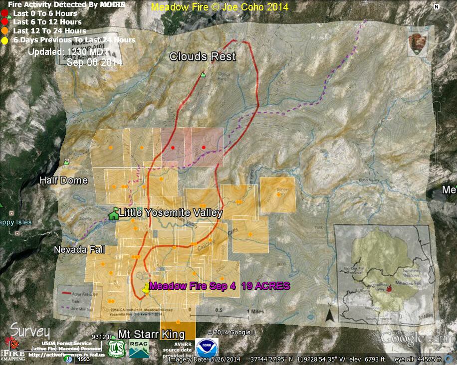
Meadow Fire MODIS & AVHRR Fire Detections 1100 MDT Sep 08 2014
Joe Coho "Meadow Fire MODIS & AVHRR Fire Detections 1100 MDT Sep 08 2014.
The red footprints are from AVHRR, NOAA-19, at 0302 PDT Sep 8.
No new MODIS data has been supplied. The original small Meadow Fire of 19 acres on Sep 4 is also shown."
Thanks to Joe Coho for the map.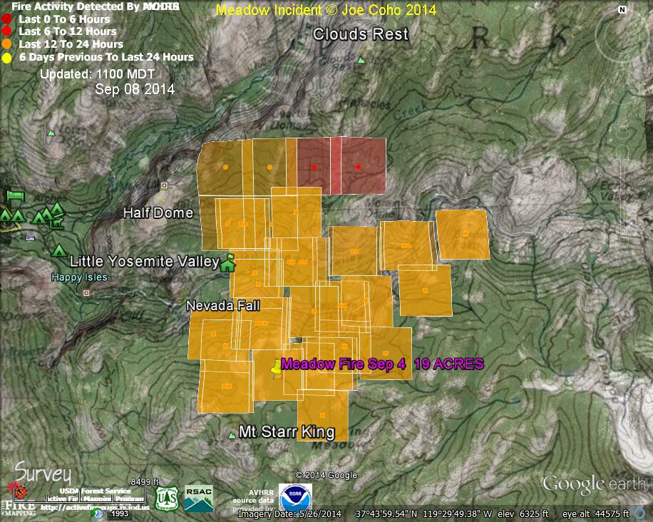
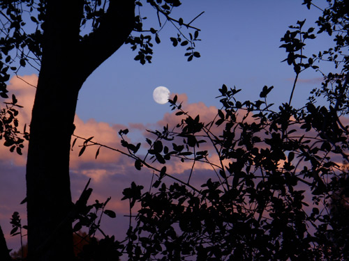 Tina Buirch captured this image from the Mount Bullion area of Mariposa County yesterday evening as the sun was setting.
Thanks for the photo Tina.
National Park Service Update: 9:12 A.M.
Meadow (37 42.738 x 119 30.541 – Mariposa Co., 7,870’, August 16) A fire, that may be a spot fire, from the Meadow lightning-caused fire, was discovered at approximately 12:30 PM, Sunday September 7. The fire is approximately 2,582 acres. It is burning within the Little Yosemite Valley (LYV) on both sides of the Merced River. All trails in the area are closed. Approximately 100 hikers and backpackers were evacuated from the fire area in LYV. The fire is burning in Yosemite Wilderness. The High Sierra Camps were seasonally closed today.
Eighty-five hikers and climbers were also evacuated from the summit of Half Dome by helicopters from the California Highway Patrol, US Department of Agriculture Forest Service, Sequoia Kings Canyon National Park, and CAL Fire.
The South Central Sierra Interagency Management Team will begin management of the fire at 6 PM, September 8, 2014.
Resources:
- 4 Type 1(heavy helicopters),
- 3 Type 2 (medium helicopters)
- 1 Air Attack
- 3 Air Tankers
- Over 100 firefighters are assigned, including Yosemite fire crews and 6 Hot Shot crews
Closed Trails:
- Echo Creek Drainage to Little Yosemite Valley
- Sunrise Creek Drainage to Little Yosemite Valley (John Muir Trail)
- Merced River Corridor to Merced Lake Ranger Station
- Nevada Fall east through Little Yosemite Valley along the Merced River corridor.
- Sunrise trail to Clouds Rest from Tenaya Lake
Smoke Impacts: Visitors, campers, employees are likely to have air quality smoke impacts overnight and early morning hours in Yosemite Valley. Key points:
- Fires of this magnitude, in this area of the park have in the past produce heavy smoke that drains down into Yosemite Valley, so be prepared for smoke in the Unhealthy AQI range or worse in the mornings, with some clearing in the afternoon hours.
- Information for schools can be found on this site, and links to current air quality updates for this incident will be posted on the California Smoke Information blog.
As with any fire incident in Yosemite National Park, firefighter and public safety is our number one priority. We appreciate everyone’s assistance with this priority.
Map showing fire area: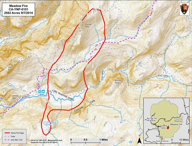
Map showing wilderness trail closures: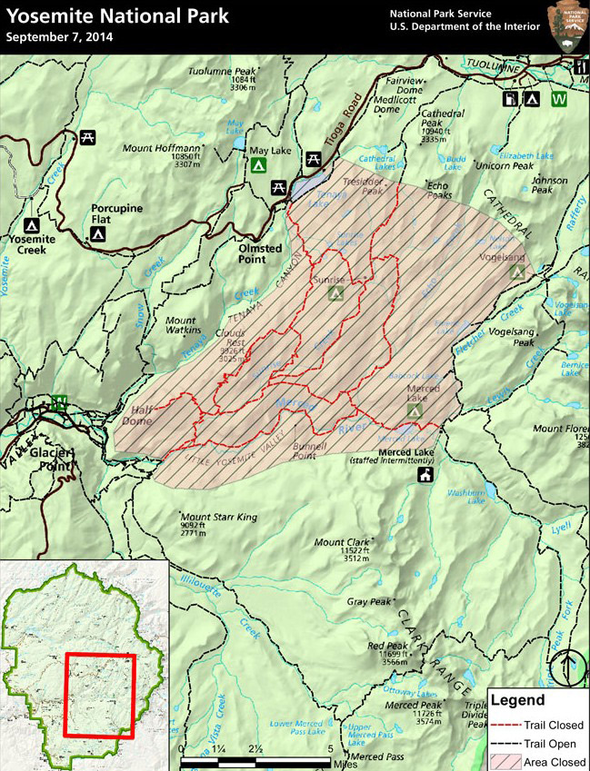
7:50 A.M.
Ch 30 Fresno says 2,600 acres and unknown containment
News media report the fire at 700 plus acres.
National Park Service:
All trails from the top of Nevada Fall to Merced Lake, including trails leading to that area, are closed. Additionally, the trail from Sunrise Lakes Trailhead to Sunrise Lakes and Sunrise Lakes High Sierra Camp, and the trails from the camp to the trail along the Merced River east of Little Yosemite Valley, are closed.
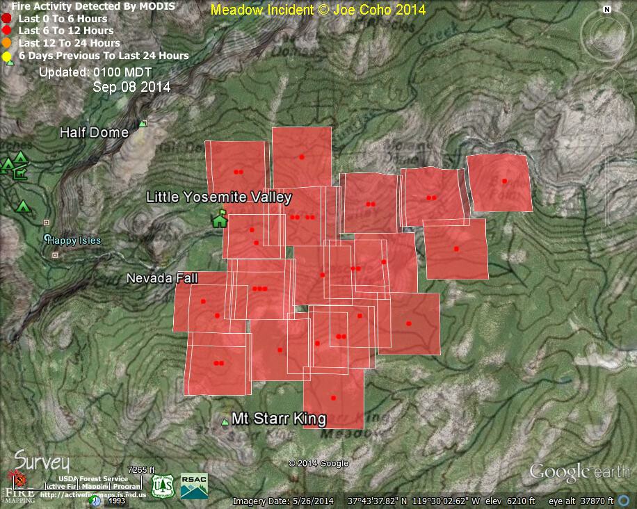
Meadow Fire in Yosemite National Park MODIS Fire Detections 0100 MDT Sep 08 2014
Joe Coho "Meadow Fire MODIS Fire Detections 0100 MDT Sep 08 2014."
Thanks to Joe Coho for the map.