Meadow Fire in Yosemite National Park Information for Tuesday, September 9, 2014
Tuesday Evening Update:
The fire was first discovered on July 19th 2014, near Starr King Lake after a lightning storm passed through the area.
The fire is in an area designated as wilderness in Yosemite National Park, within the Little Yosemite Valley, Mariposa County.
The original fire was impacted by a wind event that caused the fire to spread significantly.
Little Yosemite Valley between Half Dome and Mount Starr King
4400 acres, 10% contained
Type 2 Central Sierra IMT 2 (Cooper) in command.
Fire is burning on both sides of the Merced River.
Little Yosemite Valley Campground is closed
Sunrise High Sierra Camp and Merced Lake High Sierra Camp closures in effect.
Moderate fire activity today with some crowning and torching.
Crews are spike out with a 4 hour hike into the fire area.
Bears continue to be a major issue with crew safety in spike camp and on line.
Extensive measures are being taken not to attract bears to food and supplies.
Commitment of Forest Service air and ground resources
Update: 5:22 P.M.
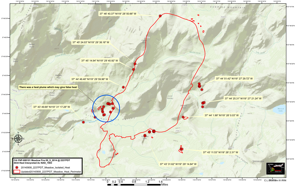
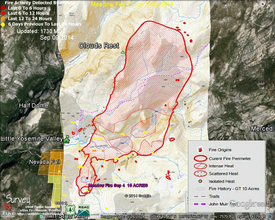
Meadow Fire MODIS Fire Detections 1730 MDT Sep 09 2014 with NPS fire map & legend Sep 9 2014
Joe Coho "Meadow Fire MODIS Fire Detections 1730 MDT Sep 09 2014 with NPS fire map & legend for Sep 9 2014.
There are two maps, first one that better shows the MODIS fire detections, and then one that emphasizes the fire map with fire intensities and trail features.
The fire size as shown is 4434 acres
Thanks to Joe Coho for the maps.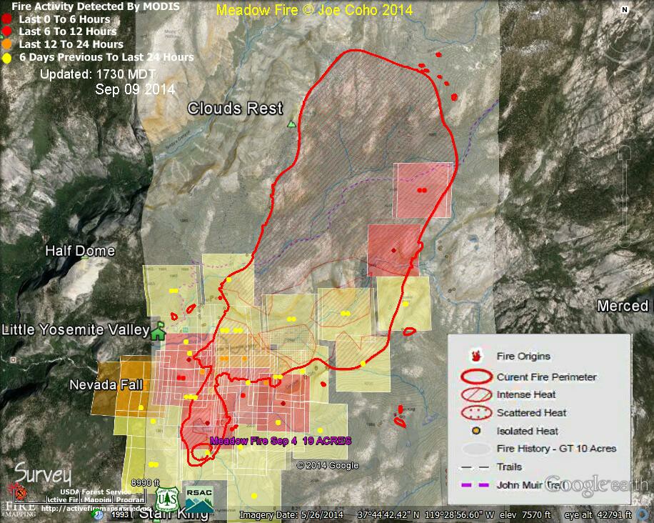
Update: 1:20 P.M.
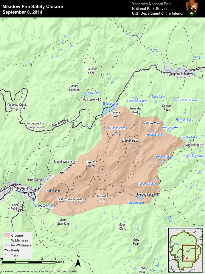
Meadow Fire Safety Closure
The Meadow Fire is at 4,434 acres with 327 personnel and eight aircraft assigned.
Conditions are smoky and are predicted to remain smoky for the next few days.
Meadow Fire Safety Closure
The Meadow Fire has progressed rapidly and in multiple directions. In order to maintain the safety of park visitors and allow fire management operations to continue unimpeded, the Superintendent of Yosemite National Park is designating a portion of Yosemite Wilderness as closed. The area will be closed until further notice is given.
By order of the Superintendent of Yosemite National Park and under authority of Title 36, Code of Federal Regulations, Section 1.5(a) and Section (a)(1):
The area marked as closed on the accompanying map entitled Meadow Fire Safety Closure dated September 8, 2014.
Features and facilities that are closed include, but are not limited to:
- Little Yosemite Valley
- The John Muir Trail between Little Yosemite Valley and Long Meadow.
- All routes on Half Dome including the Cables, NW Regular Route, and Snake Dike.
- Sunrise and Merced Lake High Sierra Camps and backpackers' camps.
- The Sunrise Trail south of the Tenaya Lake Trail junction.
- Clouds Rest, Sunrise Lakes, Emeric Lake, and Babcock Lake.
These trails and areas remain open:
- The Mist, John Muir, and Panorama Trails to the top of Nevada Fall.
- Vogelsang Backpackers' Camp.
- The Tenaya Lake Trail
- Fletcher Creek Trail between Vogelsang and Merced Lake Ranger Station
Meadow Fire Perimeter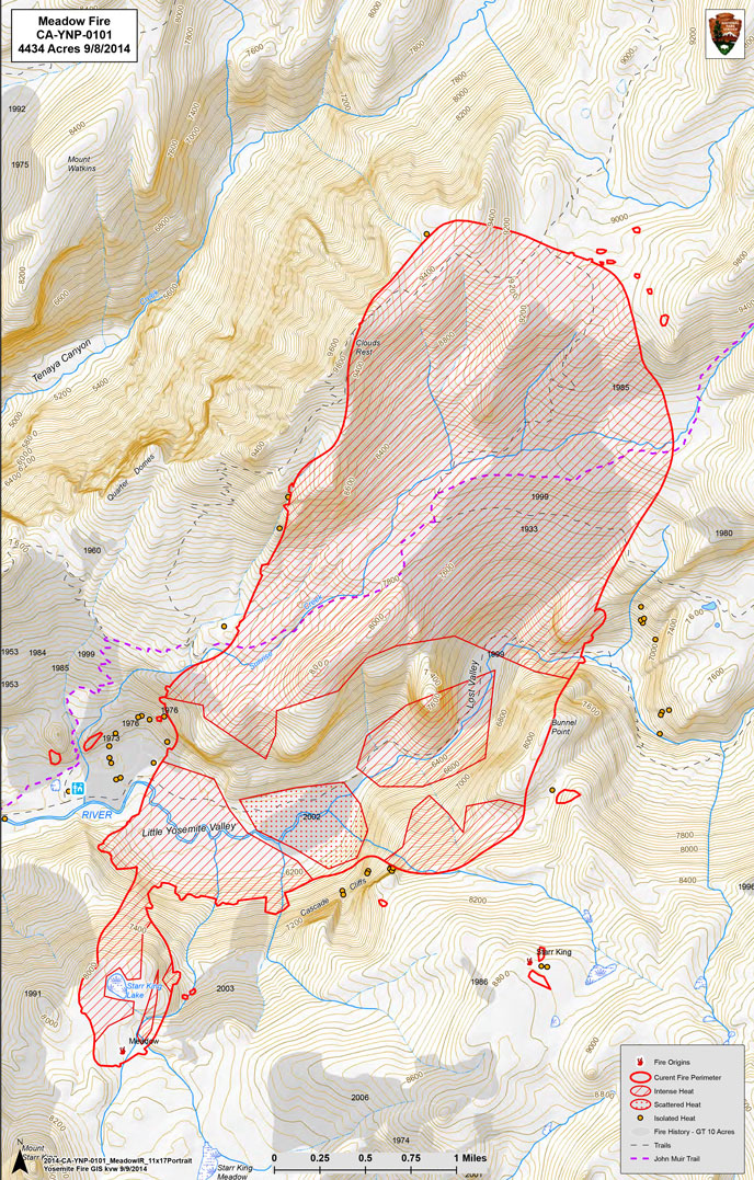
11:30 A.M.
Meadow Fire MODIS Fire Detections 11:30 MDT Sep 09 2014 with fire boundary Sep 8 22:37
Thanks to Joe Coho for the map.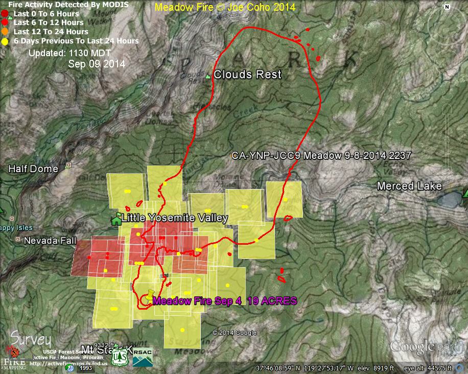
4400 acres, 5% contained
Tuesday Morning Meadow Fire in Yosemite National Park Update
This map is a heat map