


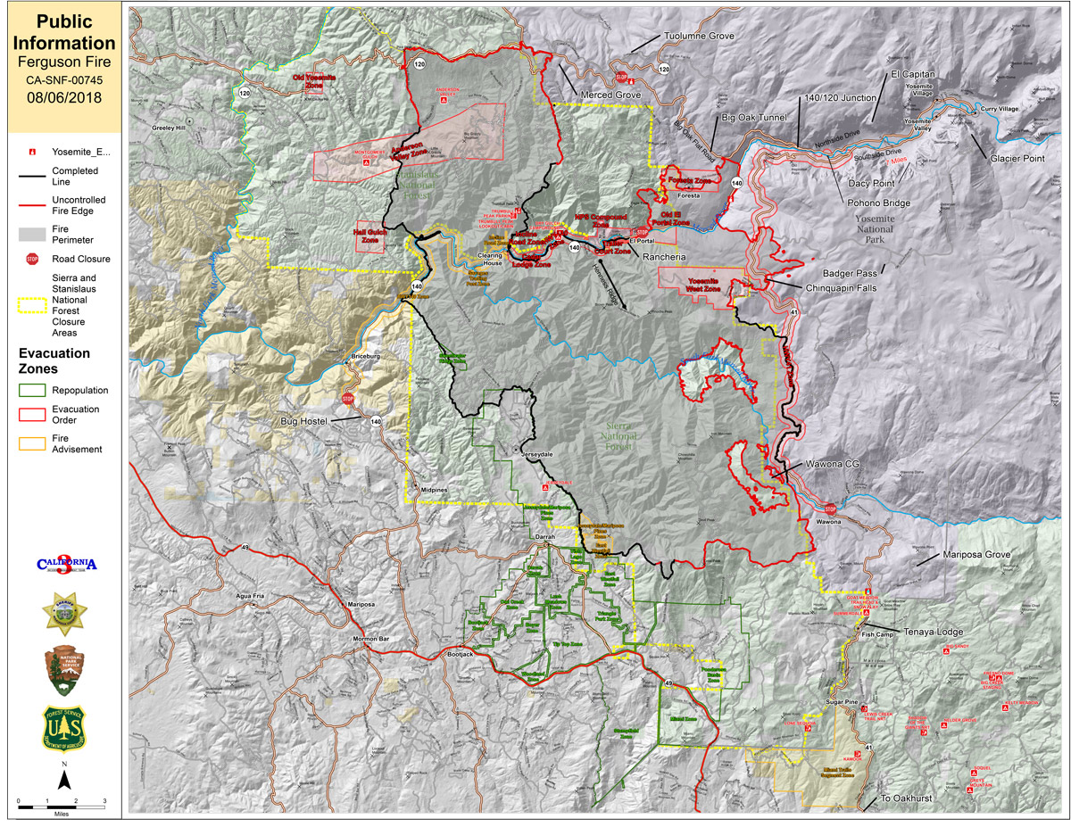
Monday Public Information Map
CLICK HERE FOR A LARGE MAP (3,000 Pixels Wide and 3.0MB)

Click here for the Sierra Sun Times Scanner
Reminder: Scanner Information is NOT Official
Click here for Sunday's Information on the Ferguson Fire
Estimated Acreage: 91,502 93,648
Update: 7:26 P.M. Ferguson Fire Near Yosemite National Park in Mariposa County Monday Evening, August 6, 2018 Update: 94,331 Acres with 39% Containment
Update: 6:39 P.M. Ferguson Fire Evacuation Order Lifted for All Areas in El Portal in Mariposa County on Monday, August 6, 2018
Update: 5:31 P.M. Caltrans Extends State Route 120 West Closure to White Wolf in Yosemite National Park Due to Ferguson Fire in Mariposa County
Update: 4:25 P.M. Yosemite National Park Fire Chief Explains Safety Reasons for Park Closure
Update: 1:17 P.M. California’s Public Lands Affected By Ferguson Fire and Other Wildfires: Know Before You Go, CDFW Says
Update: 1:00 P.M. Mariposa County Offices Reduce Services Due to Unhealthy Air Quality from the Ferguson Fire Near Yosemite
Update: 10:00 A.M. Mariposa County Sheriff’s Office Reports Evacuation Order for Wawona Due to the Ferguson Fire has been Lifted
(Spanish Video Added)
Update: 10:00 A.M. Sierra National Forest Operational Update Video for the Ferguson Fire on August 6, 2018
Update: 7:45 A.M. Forest Service Wildland Fire Smoke/Air Quality Outlook of the Yosemite Area for Monday, August 6 - Includes Mariposa, Oakhurst and Yosemite
Update: 7:00 A.M. Ferguson Fire Near Yosemite National Park in Mariposa County Monday Morning, August 6, 2018 Update: 91,502 Acres with Containment at 38%
Update: 5:30 A.M. Ferguson Fire Near Yosemite National Park in Mariposa County Monday, August 6 Operations Map
Update: 7:19 P.M. Ferguson Fire Near Yosemite National Park in Mariposa County Sunday Evening, August 5, 2018 Update: 89,633 Acres with 38% Containment
Update: 3:56 P.M. Yosemite Valley and Other Sections of the Park Remain Closed Indefinitely Due to Impacts from the Ferguson Fire

