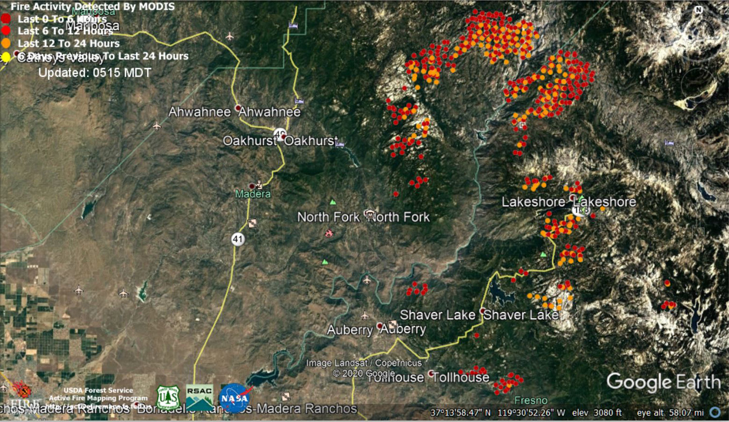
Note: 1,500 Wide and older yellow detections removed
MODIS Active Fire Mapping Program Frequently Asked Questions
Update 8:50 P.M. Per CAL FIRE: Evening Update in English (click for full 14 page PDF) and in Spanish.
Update 7:30 P.M.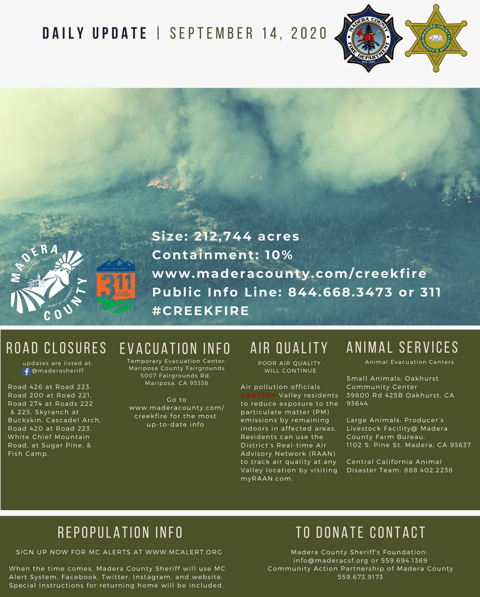
Update 7:40 P.M. LIVE - Sierra National Forest to Hold a Livestream Incident Briefing with CAL FIRE for the Creek Fire on Monday, September 14 at 7:00 P.M.
Update 7:20 P.M. Per CAL FIRE: The Creek Fire is now at 212,744 acres, with 10% (16% per InciWeb) contained. This evenings meeting had technical difficulties and video will be posted when available.
Update 4:35 P.M. Creek Fire Incident Management Team to Hold a Zoom Meeting for the Mammoth Lakes Area on Tuesday, September 15, 2020
Update 4:10 P.M. CAL FIRE Full Status Update on Repopulation Areas of the Creek Fire for Monday, September 14, 2020
(Full Updated List as of 4:00 P.M.)
Update 3:35 P.M. Sierra National Forest to Hold a Livestream Incident Briefing with CAL FIRE for the Creek Fire on Monday, September 14 at 7:00 P.M.
Update 3:05 P.M. Sierra National Forest Creek Fire South Zone Operations Briefing Video for Monday, September 14, 2020
Update 3:02 P.M. Per Madera County Sheriff’s Office: Evacuation Order Lifted for M52
Evacuation Orders for M52 have been reduced to Evacuation Warnings. Residents in the area need to be aware that there is still a potential for evacuations and need to be prepared to evacuate at a moment’s notice. Citizens need to monitor the situation and be prepared to take action immediately. These areas are being opened to residents only. Road 274 between Road 331 and Road 222 including Cowboy’s Trail. (Evacuation Zone 52) Road 222 between Road 274 and just east of Road 331 before the docks. (Evacuation Zone 52)
Update 3:00 P.M. Per Madera County Sheriff’s Office: Evacuation Warnings Lifted for M49, M50, M51
The Madera County Sheriff's Office is pleased to announce the evacuation warnings for Evacuation Zones M49 Road 422, M50, John West and M51 Upper Road 426 have been lifted. Please go to the Madera County Web Page and click on the fire map to see more information.
Update 2:39 P.M. CAL FIRE Announces the Following Evacuation Orders are Reduced to Evacuation Warnings
Update 1:36 P.M. Forest Service Wildland Fire Smoke/Air Quality Outlook Due to the Creek Fire in the Yosemite Area for September 14 & 15, 2020
Update 11:30 A.M.: Sierra National Forest Creek Fire North Zone Operations Briefing Video For Monday, September 14, 2020
Update 7:50 A.M. CAL FIRE: 212,744 Acres with 10% Containment and 14,074 Structures Threatened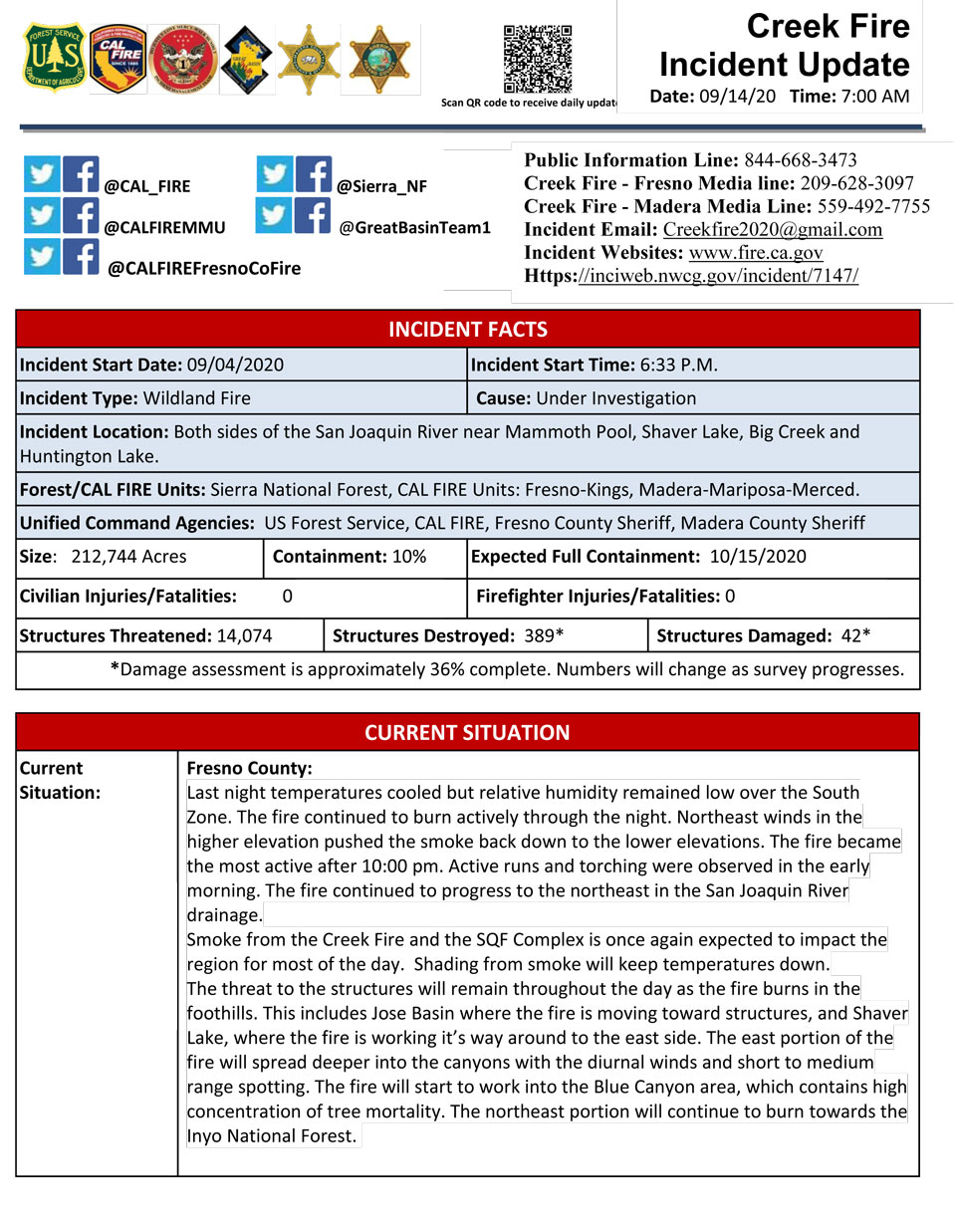
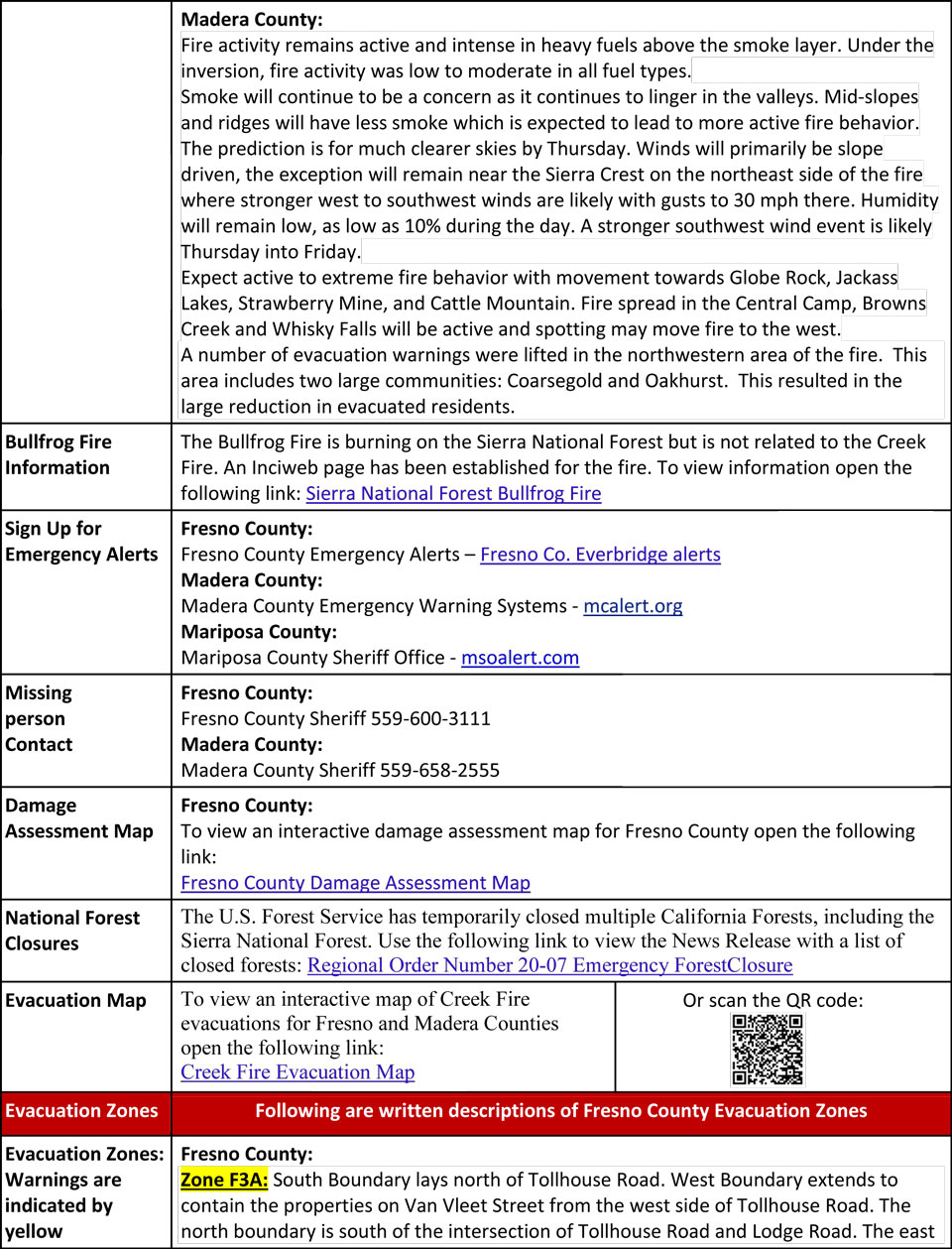
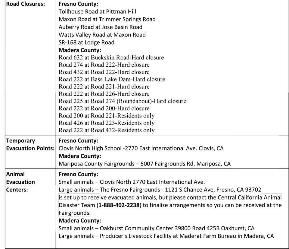
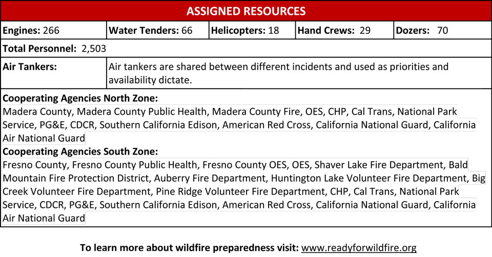
Update 5:30 A.M.: Sierra National Forest Creek Fire Operations Briefing Map for Monday, September 14, 2020 - Shows Divisions, Uncontrolled Fire Edge, Completed Dozer Lines, Proposed Dozer Lines
September 14, 2020 - Overnight infrared mapping has the Creek Fire at 212,744 Interpreted Acres.
Comments and notes on flight:
New perimeter was used from the FTP. It includes many points and polygons outside the perimeter. Many of these polygons were very far from the burn and not investigated for heat. Heat was only detected where the Isolated, Scattered, and Intense heat polygons are denoted on the maps and in the shape files although the extra polygons are retained for reference.
The majority of growth is in Divisions I, J, M, and N off the Northwest, North, and Northeast sides. Two areas of heat were detected in a valley 1 mile north from the perimeter. There is considerable spotting off the northern borders The center valley continues to cool while some of the unburned areas are now hot near Huntington Lake in Div R.
Sunday Evening Update: 201,908 acres and 10% containment, with 2,503 total fire personnel.
Sierra National Forest Creek Fire Updates for Sunday, September 13, 2020


